
ឯកសារ:Myanmar location map.svg

Size of this PNG preview of this SVG file: ២៨៥ × ៥៩៩ ភីកសែ. ភាពម៉ត់ផ្សេងទៀត៖ ១១៤ × ២៤០ ភីកសែ | ២២៨ × ៤៨០ ភីកសែ | ៣៦៥ × ៧៦៨ ភីកសែ | ៤៨៧ × ១០២៤ ភីកសែ | ៩៧៥ × ២០៤៨ ភីកសែ | ១២០០ × ២៥២០ ភីកសែ។
រូបភាពដើម (ឯកសារប្រភេទSVG ១២០០ × ២៥២០ ភីកសែល ទំហំឯកសារ៖ ៦៣៣គីឡូបៃ)
ចំណារពន្យល់
| ការពិពណ៌នា |
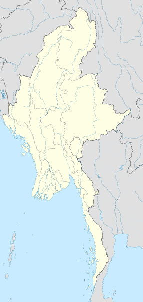
English: Location map of Myanmar. Equirectangular projection. Strechted by 105.0%. Geographic limits of the map: * N: 29.0° N * S: 9.0° N * W: 92.0° E * E: 102.0° E Made with Natural Earth. Free vector and raster map data @ naturalearthdata.com. |
| កាលបរិច្ឆេទ | |
| ប្រភព | ការងារផ្ទាល់របស់អ្នកផ្ទុកឡើង |
| អ្នកនិពន្ធ | Uwe Dedering |
ការដាក់អាជ្ញាប័ណ្ណ
I, the copyright holder of this work, hereby publish it under the following licenses:
ឯកសារនេះជាប់អាជ្ញាបណ្ឌCreative Commons Attribution-Share Alike 3.0 Unported។
- អ្នកមានសិទ្ធិ៖
- ចែកចាយ – ថតចំលងនិងចែកចាយស្នាដៃនេះ
- កែច្នៃ – កែច្នៃយកទៅប្រើ
- ក្រោមលក្ខខណ្ឌដូចតទៅនេះ៖
- ភាពជាម្ចាស់កម្មសិទ្ធ – You must give appropriate credit, provide a link to the license, and indicate if changes were made. You may do so in any reasonable manner, but not in any way that suggests the licensor endorses you or your use.
- share alike – If you remix, transform, or build upon the material, you must distribute your contributions under the same or compatible license as the original.

|
រូបភាពនៃទំព័រនេះជាកម្មសិទ្ធិរបស់GNU Free Documentation License។ Version 1.2 ឬក៏ខ្ពស់ជាងនេះត្រូវបានឧបត្ថមគាំទ្រដោយ មូលនិធិសូហ្វវែរដោយឥតគិតថ្លៃ (Free Software Foundation) ដែលមិនមានផ្នែកណាមួយរបស់ប្រភពដើមរួមទាំងអក្សរនៅលើគំរបមុខនិងខ្នង ត្រូវបានផ្លាស់ប្តូរទេ។ ចំពោះផ្នែកដែលមិនអាចផ្លាស់ប្តូរបាន សូមមើលGNU Free Documentation License។ |
You may select the license of your choice.
| Annotations | This image is annotated: View the annotations at Commons |
ប្រវត្តិឯកសារ
ចុចលើម៉ោងនិងកាលបរិច្ឆេទដើម្បីមើលឯកសារដែលបានផ្ទុកឡើងនៅពេលនោះ។
| ម៉ោងនិងកាលបរិច្ឆេទ | កូនរូបភាព | វិមាត្រ | អ្នកប្រើប្រាស់ | យោបល់ | |
|---|---|---|---|---|---|
| បច្ចុប្បន្ន | ម៉ោង១៦:០៨ ថ្ងៃព្រហស្បតិ៍ ទី២៩ ខែកញ្ញា ឆ្នាំ២០១១ | | ១២០០ × ២៥២០ (៦៣៣គីឡូបៃ) | NordNordWest | corr, see disk |
| ម៉ោង១៧:៤៥ ថ្ងៃព្រហស្បតិ៍ ទី១៨ ខែកុម្ភៈ ឆ្នាំ២០១០ |  | ១២០០ × ២៥២០ (៩៦៨គីឡូបៃ) | Uwe Dedering | no disputed countries | |
| ម៉ោង១៣:០៣ ថ្ងៃព្រហស្បតិ៍ ទី១៨ ខែកុម្ភៈ ឆ្នាំ២០១០ |  | ១២០០ × ២៥២០ (៩៧៤គីឡូបៃ) | Uwe Dedering | {{Information |Description={{en|1=Location map of Myanmar. Equirectangular projection. Strechted by 105.0%. Geographic limits of the map: * N: 29.0° N * S: 9.0° N * W: 92.0° E * E: 102.0° E Made with Natural Earth. Free vector and raster map dat |
បម្រើបម្រាស់ឯកសារ
7 ទំព័រ ខាងក្រោមប្រើប្រាស់ឯកសារនេះ ៖
បម្រើបម្រាស់ឯកសារជាសាកល
វីគីដទៃទៀតដូចខាងក្រោមនេះប្រើប្រាស់ឯកសារនេះ៖
- ការប្រើប្រាស់នៅក្នុង af.wikipedia.org
- ការប្រើប្រាស់នៅក្នុង an.wikipedia.org
- ការប្រើប្រាស់នៅក្នុង ar.wikipedia.org
- ការប្រើប្រាស់នៅក្នុង az.wikipedia.org
- ការប្រើប្រាស់នៅក្នុង ba.wikipedia.org
- ការប្រើប្រាស់នៅក្នុង be.wikipedia.org
- ការប្រើប្រាស់នៅក្នុង bg.wikipedia.org
- ការប្រើប្រាស់នៅក្នុង bh.wikipedia.org
- ការប្រើប្រាស់នៅក្នុង bn.wikipedia.org
View more global usage of this file.