
ឯកសារ:Portuguesee map of SouthEast Asia in the 17th century.jpg
ទំហំរបស់ការមើលមុននេះ: ៤២៩ × ៦០០ ភីកសែ។ ភាពម៉ត់ផ្សេងទៀត៖ ១៧២ × ២៤០ ភីកសែ | ៣៤៣ × ៤៨០ ភីកសែ | ៥៤៩ × ៧៦៨ ភីកសែ | ១០៤៦ × ១៤៦២ ភីកសែ។
រូបភាពដើម (១០៤៦ × ១៤៦២ ភីកសែល ទំហំឯកសារ៖ ១.៨៨មេកាបៃ ប្រភេទ MIME៖ image/jpeg)
ចំណារពន្យល់
| ការពិពណ៌នា |
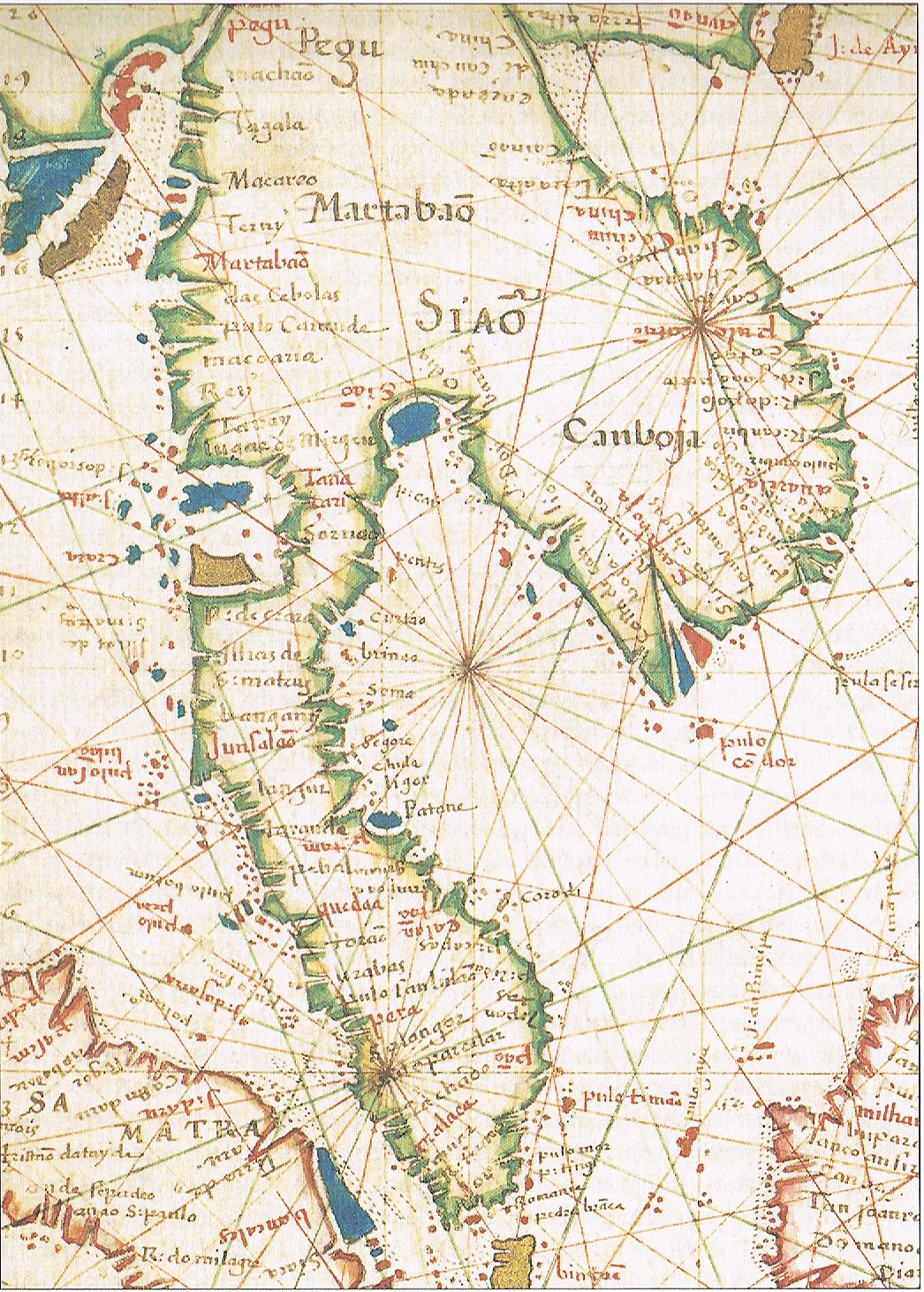
English: Portuguese Map of IndoChina in the 17th century |
| កាលបរិច្ឆេទ | |
| ប្រភព | Portuguese Atlas |
| អ្នកនិពន្ធ | អនាមិក |
ការដាក់អាជ្ញាប័ណ្ណ
This work is in the public domain in the United States because it was published (or registered with the U.S. Copyright Office) before January 1, 1929.
Public domain works must be out of copyright in both the United States and in the source country of the work in order to be hosted on the Commons. If the work is not a U.S. work, the file must have an additional copyright tag indicating the copyright status in the source country.
Note: This tag should not be used for sound recordings. |
ប្រវត្តិឯកសារ
ចុចលើម៉ោងនិងកាលបរិច្ឆេទដើម្បីមើលឯកសារដែលបានផ្ទុកឡើងនៅពេលនោះ។
| ម៉ោងនិងកាលបរិច្ឆេទ | កូនរូបភាព | វិមាត្រ | អ្នកប្រើប្រាស់ | យោបល់ | |
|---|---|---|---|---|---|
| បច្ចុប្បន្ន | ម៉ោង០៧:២៩ ថ្ងៃសៅរ៍ ទី២៩ ខែធ្នូ ឆ្នាំ២០១២ | | ១០៤៦ × ១៤៦២ (១.៨៨មេកាបៃ) | Pwordissony | User created page with UploadWizard |
បម្រើបម្រាស់ឯកសារ
ទំព័រ ខាងក្រោមប្រើប្រាស់ឯកសារនេះ ៖
បម្រើបម្រាស់ឯកសារជាសាកល
វីគីដទៃទៀតដូចខាងក្រោមនេះប្រើប្រាស់ឯកសារនេះ៖
- ការប្រើប្រាស់នៅក្នុង en.wikipedia.org
- ការប្រើប្រាស់នៅក្នុង id.wikipedia.org
- ការប្រើប្រាស់នៅក្នុង pt.wikipedia.org
- ការប្រើប្រាស់នៅក្នុង ru.wikipedia.org
- ការប្រើប្រាស់នៅក្នុង uk.wikipedia.org
- ការប្រើប្រាស់នៅក្នុង zh.wikipedia.org