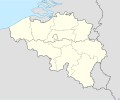
ឯកសារ:Belgium location map.svg

Size of this PNG preview of this SVG file: ៦៨៩ × ៥៩៩ ភីកសែ. ភាពម៉ត់ផ្សេងទៀត៖ ២៧៦ × ២៤០ ភីកសែ | ៥៥២ × ៤៨០ ភីកសែ | ៨៨៣ × ៧៦៨ ភីកសែ | ១១៧៧ × ១០២៤ ភីកសែ | ២៣៥៥ × ២០៤៨ ភីកសែ | ១១៣៦ × ៩៨៨ ភីកសែ។
រូបភាពដើម (ឯកសារប្រភេទSVG ១១៣៦ × ៩៨៨ ភីកសែល ទំហំឯកសារ៖ ១២០គីឡូបៃ)
ប្រវត្តិឯកសារ
ចុចលើម៉ោងនិងកាលបរិច្ឆេទដើម្បីមើលឯកសារដែលបានផ្ទុកឡើងនៅពេលនោះ។
| ម៉ោងនិងកាលបរិច្ឆេទ | កូនរូបភាព | វិមាត្រ | អ្នកប្រើប្រាស់ | យោបល់ | |
|---|---|---|---|---|---|
| បច្ចុប្បន្ន | ម៉ោង១៨:២៦ ថ្ងៃព្រហស្បតិ៍ ទី២៣ ខែកញ្ញា ឆ្នាំ២០១០ |  | ១១៣៦ × ៩៨៨ (១២០គីឡូបៃ) | NordNordWest | upd |
| ម៉ោង១៨:៤២ ថ្ងៃច័ន្ទ ទី២៥ ខែសីហា ឆ្នាំ២០០៨ |  | ១១៣៦ × ៩៤៥ (១៥៩គីឡូបៃ) | NordNordWest | size correction | |
| ម៉ោង១៩:០១ ថ្ងៃពុធ ទី០៩ ខែកក្កដា ឆ្នាំ២០០៨ |  | ៣៧៩ × ៣១៥ (១៥៦គីឡូបៃ) | NordNordWest | {{Information |Description= {{de|Positionskarte von Belgien}} Quadratische Plattkarte, N-S-Streckung 150 %. Geographische Begrenzung der Karte: * N: 51.8° N * S: 49.2° N * W: 2.2° O * O: 6.9° O {{en|Location map of [[:en:Belgium|Belgiu |
បម្រើបម្រាស់ឯកសារ
គ្មានទំព័រណាមួយដែលប្រើប្រាស់ឯកសារនេះទេ។
បម្រើបម្រាស់ឯកសារជាសាកល
វីគីដទៃទៀតដូចខាងក្រោមនេះប្រើប្រាស់ឯកសារនេះ៖
- ការប្រើប្រាស់នៅក្នុង ar.wikipedia.org
- ការប្រើប្រាស់នៅក្នុង av.wikipedia.org
- ការប្រើប្រាស់នៅក្នុង azb.wikipedia.org
- ការប្រើប្រាស់នៅក្នុង ban.wikipedia.org
- ការប្រើប្រាស់នៅក្នុង be.wikimedia.org
- Wiki Loves Monuments/website/Photo tour 28 September 2014/lb
- Wiki Loves Monuments/website/Photo tour 28 September 2014/fr
- Wiki Loves Monuments/website/Photo tour 28 September 2014/de
- Wiki Loves Monuments/website/Photo tour 28 September 2014/nl
- Wiki Loves Monuments/website/Photo tour 28 September 2014
- Uitnodiging voor de fototocht Wiki Takes... Leuven op 28 september 2014
- Invitation to the photo tour Wiki Takes... Leuven on 28 September 2014
- Invitation balade photographique Wiki Takes... Louvain, le 28 Septembre 2014
- ការប្រើប្រាស់នៅក្នុង bn.wikipedia.org
- ការប្រើប្រាស់នៅក្នុង bs.wikipedia.org
- ការប្រើប្រាស់នៅក្នុង ca.wikipedia.org
- ការប្រើប្រាស់នៅក្នុង ceb.wikipedia.org
View more global usage of this file.


