
ឯកសារ:Europe countries map km 2.png
ទំហំរបស់ការមើលមុននេះ: ៧៣៧ × ៦០០ ភីកសែ។ ភាពម៉ត់ផ្សេងទៀត៖ ២៩៥ × ២៤០ ភីកសែ | ៥៩០ × ៤៨០ ភីកសែ | ៩៤៤ × ៧៦៨ ភីកសែ | ១២៥៩ × ១០២៤ ភីកសែ | ១៤៧៥ × ១២០០ ភីកសែ។
រូបភាពដើម (១៤៧៥ × ១២០០ ភីកសែល ទំហំឯកសារ៖ ៤៥១គីឡូបៃ ប្រភេទ MIME៖ image/png)
| ការពិពណ៌នា |
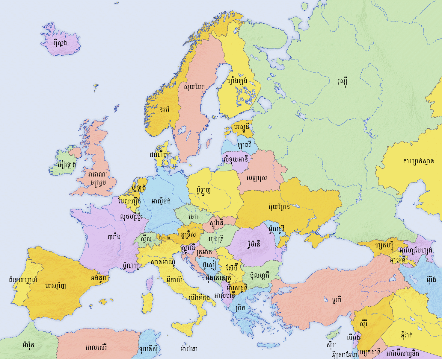
English: Map of countries in Europe and the surrounding region |
||||||||||
| កាលបរិច្ឆេទ | |||||||||||
| ប្រភព |
|
||||||||||
| អ្នកនិពន្ធ | San Jose (map) | ||||||||||
| ការអនុញ្ញាត (ប្រើឯកសារនេះឡើងវិញ) |
|
||||||||||
| ទំរង់ផ្សេងទៀត |
[]
|


See also
_en.png)
.png)
.jpg)
ប្រវត្តិឯកសារ
ចុចលើម៉ោងនិងកាលបរិច្ឆេទដើម្បីមើលឯកសារដែលបានផ្ទុកឡើងនៅពេលនោះ។
| ម៉ោងនិងកាលបរិច្ឆេទ | កូនរូបភាព | វិមាត្រ | អ្នកប្រើប្រាស់ | យោបល់ | |
|---|---|---|---|---|---|
| បច្ចុប្បន្ន | ម៉ោង១៥:៣៨ ថ្ងៃសុក្រ ទី១៩ ខែកុម្ភៈ ឆ្នាំ២០១០ | | ១៤៧៥ × ១២០០ (៤៥១គីឡូបៃ) | Kiensvay | {{Information |Description={{en|1=Map of countries in Europe and the surrounding region}} |Source={{Retouched picture|1=Saturation, brightness, contrast|editor=Kiensvay|orig=Europe countries map ja.png|origoff=}} |Author=San Jose (map) | |
បម្រើបម្រាស់ឯកសារ
ទំព័រ ខាងក្រោមប្រើប្រាស់ឯកសារនេះ ៖