
ឯកសារ:Japan (orthographic projection).svg

Size of this PNG preview of this SVG file: ៥៣៦ × ៥៣៦ ភីកសែ. ភាពម៉ត់ផ្សេងទៀត៖ ២៤០ × ២៤០ ភីកសែ | ៤៨០ × ៤៨០ ភីកសែ | ៧៦៨ × ៧៦៨ ភីកសែ | ១០២៤ × ១០២៤ ភីកសែ | ២០៤៨ × ២០៤៨ ភីកសែ។
រូបភាពដើម (ឯកសារប្រភេទSVG ៥៣៦ × ៥៣៦ ភីកសែល ទំហំឯកសារ៖ ២.៨៩មេកាបៃ)
ចំណារពន្យល់
| ការពិពណ៌នា |
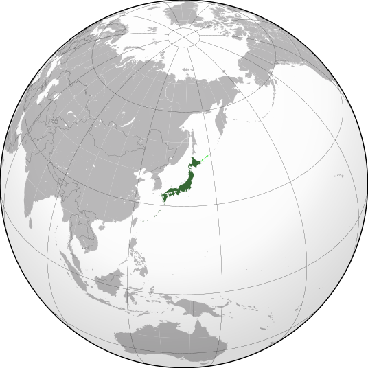
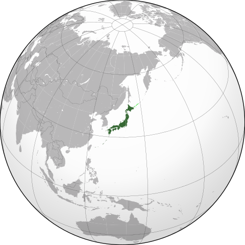
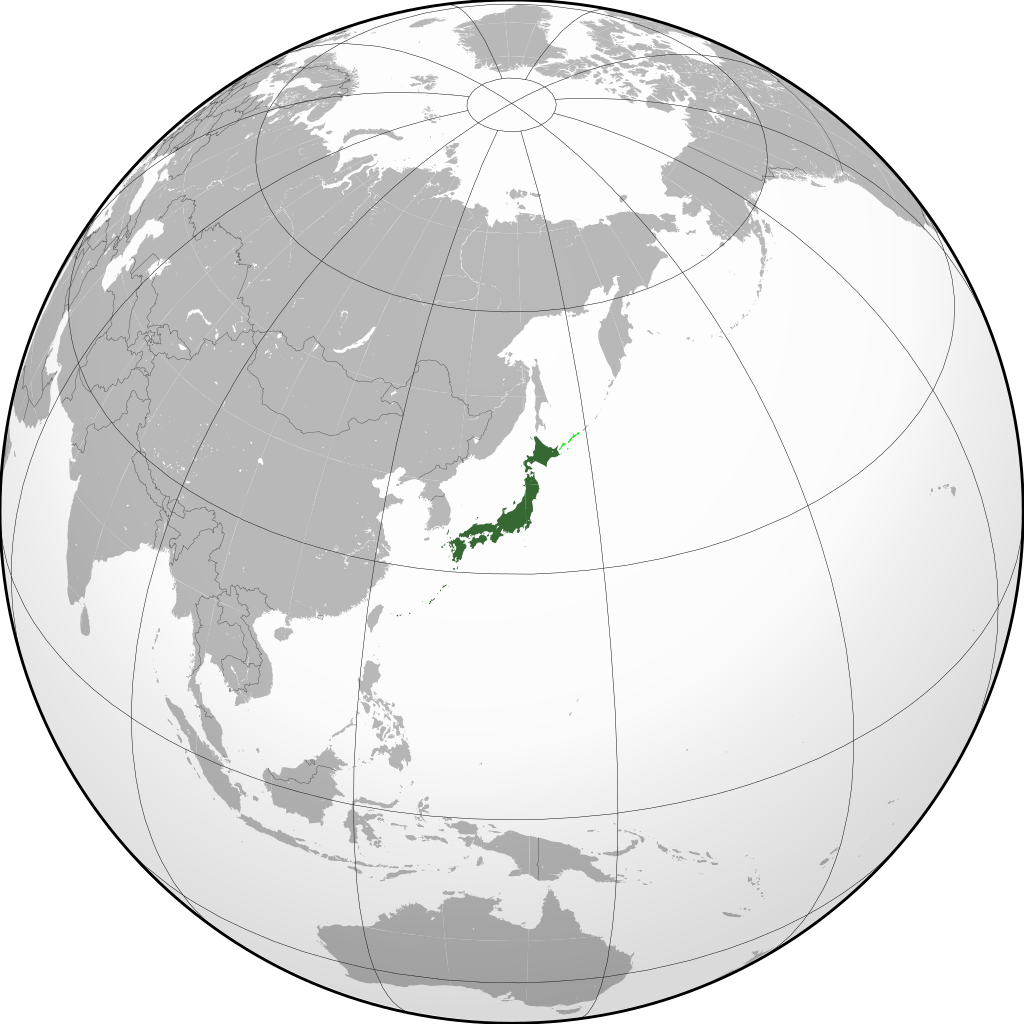
English: Orthographic Projection of Japan (green). |
||
| កាលបរិច្ឆេទ | |||
| ប្រភព | ការងារផ្ទាល់របស់អ្នកផ្ទុកឡើង | ||
| អ្នកនិពន្ធ | Connormah | ||
| ទំរង់ផ្សេងទៀត |
Derivative works of this file: Japanese Empire (orthographic projection).svg .svg)
|
||
| SVG genesis | រូបភាពក្រាភិកវ៉ិចទ័រនេះត្រូវបានបង្កើតឡើងដោយប្រើ Inkscape. |
.svg)
.svg)
.svg)
.svg)
.svg)
.svg)
.svg)
.svg)
.svg)
.svg)
.svg)
.svg)
.svg)
.svg)
.svg)
.svg)
.svg)
.svg)
.svg)
.svg)
.svg)
.svg)
.svg)
.svg)
.svg)
.svg)
.svg)
.svg)
.svg)
.svg)
.svg)
.svg)
.svg)
.svg)
.svg)
.svg)
.svg)
.svg)
.svg)
.svg)
.svg)
.svg)
.svg)
.svg)
.svg)
.svg)
.svg)
.svg)
.svg)
.svg)
.svg)
.svg)
.svg)
.svg)
.svg)
.svg)
.svg)
.svg)
.svg)
.svg)
.svg)
.svg)
.svg)
.svg)
.svg)
.svg)
.svg)
.svg)
.svg)
.svg)
.svg)
.svg)
.svg)

.svg)

.svg)

.svg)
.svg)
.svg)
.svg)
.svg)
.svg)
.svg)


.svg)
.svg)
.svg)
.svg)
.svg)
.svg)
.svg)

.svg)
.svg)
.svg)
.svg)
.svg)
.svg)
.svg)
.svg)
.svg)

.svg)
.svg)
.svg)
.svg)
.svg)
.svg)
.svg)
_without_national_boundaries.svg)
.svg)
.svg)
.svg)
.svg)
.svg)
.svg)

.svg)
.svg)
.png)
.svg)
.svg)
.svg)
.svg)

.svg)
.svg)
.svg)
.svg)
.svg)
.svg)
.svg)
.svg)
.svg)
.svg)
.svg)

.svg)
.svg)
.svg)
.svg)
.svg)
.svg)
.svg)
.svg)
.svg)

.svg)
.svg)

.svg)
.svg)
.svg)
.svg)
.svg)
.svg)
.svg)
.svg)
.svg)
.svg)
.svg)
.svg)
.svg)
.svg)
.svg)
.svg)
.svg)
.svg)
.svg)
.svg)
.svg)
.svg)
.svg)
.svg)
.svg)
.svg)
.svg)
_-_Crimea_disputed.svg)
.svg)
.svg)
.svg)
.svg)
.svg)
.svg)
.svg)
.svg)
.svg)
.svg)
.svg)
_political.svg)
.svg)
.svg)
.svg)
.svg)
_-_Crimea_disputed_-_no_borders.svg)
.svg)
.svg)
.svg)
.svg)
.svg)
.svg)
.svg)
.svg)
.svg)
.svg)
.svg)

.svg)
.svg)
.svg)

.png)
.svg)
.svg)
.svg)
.svg)
.svg)
.svg)
.svg)
.svg)
.svg)
.svg)
.svg)
.svg)
.svg)
.svg)
.svg)
.svg)
.svg)
.svg)
.svg)
.svg)
.svg)
.svg)
.svg)
.svg)
.svg)
.svg)
.svg)
.svg)
.svg)
.svg)
.svg)
.svg)
.svg)
.svg)
.png)
.svg)
.svg)
.svg)
_(orthographic_projection).png)
.svg)
.svg)
.svg)
ការដាក់អាជ្ញាប័ណ្ណ
I, the copyright holder of this work, hereby publish it under the following licenses:

|
រូបភាពនៃទំព័រនេះជាកម្មសិទ្ធិរបស់GNU Free Documentation License។ Version 1.2 ឬក៏ខ្ពស់ជាងនេះត្រូវបានឧបត្ថមគាំទ្រដោយ មូលនិធិសូហ្វវែរដោយឥតគិតថ្លៃ (Free Software Foundation) ដែលមិនមានផ្នែកណាមួយរបស់ប្រភពដើមរួមទាំងអក្សរនៅលើគំរបមុខនិងខ្នង ត្រូវបានផ្លាស់ប្តូរទេ។ ចំពោះផ្នែកដែលមិនអាចផ្លាស់ប្តូរបាន សូមមើលGNU Free Documentation License។ |
ឯកសារនេះជាប់អាជ្ញាបណ្ឌCreative Commons Attribution-Share Alike 3.0 Unported។
- អ្នកមានសិទ្ធិ៖
- ចែកចាយ – ថតចំលងនិងចែកចាយស្នាដៃនេះ
- កែច្នៃ – កែច្នៃយកទៅប្រើ
- ក្រោមលក្ខខណ្ឌដូចតទៅនេះ៖
- ភាពជាម្ចាស់កម្មសិទ្ធ – You must give appropriate credit, provide a link to the license, and indicate if changes were made. You may do so in any reasonable manner, but not in any way that suggests the licensor endorses you or your use.
- share alike – If you remix, transform, or build upon the material, you must distribute your contributions under the same or compatible license as the original.
You may select the license of your choice.
ប្រវត្តិឯកសារ
ចុចលើម៉ោងនិងកាលបរិច្ឆេទដើម្បីមើលឯកសារដែលបានផ្ទុកឡើងនៅពេលនោះ។
.svg&dir=prev)
.svg&offset=20200526195336)
.svg&offset=&limit=20)
.svg&offset=&limit=50)
.svg&offset=&limit=100)
.svg&offset=&limit=250)
.svg&offset=&limit=500)
| ម៉ោងនិងកាលបរិច្ឆេទ | កូនរូបភាព | វិមាត្រ | អ្នកប្រើប្រាស់ | យោបល់ | |
|---|---|---|---|---|---|
| បច្ចុប្បន្ន | ម៉ោង០៦:២២ ថ្ងៃព្រហស្បតិ៍ ទី១៣ ខែតុលា ឆ្នាំ២០២២ | | ៥៣៦ × ៥៣៦ (២.៨៩មេកាបៃ) | Asanagi | Reverted to version as of 02:34, 14 April 2022 (UTC) |
| ម៉ោង១៩:០៨ ថ្ងៃអង្គារ ទី១១ ខែតុលា ឆ្នាំ២០២២ |  | ៥៣៦ × ៥៣៦ (៦០៧គីឡូបៃ) | Armin Arlertz | Reverted to version as of 07:31, 13 September 2020 (UTC) | |
| ម៉ោង០២:៣៤ ថ្ងៃព្រហស្បតិ៍ ទី១៤ ខែមេសា ឆ្នាំ២០២២ |  | ៥៣៦ × ៥៣៦ (២.៨៩មេកាបៃ) | Asanagi | fix to the center | |
| ម៉ោង០៧:៣១ ថ្ងៃអាទិត្យ ទី១៣ ខែកញ្ញា ឆ្នាំ២០២០ |  | ៥៣៦ × ៥៣៦ (៦០៧គីឡូបៃ) | Goszei | Reverted to version as of 03:12, 5 September 2020 (UTC) Please read the file talk page, and COM:OVERWRITE | |
| ម៉ោង១២:១៧ ថ្ងៃពុធ ទី០៩ ខែកញ្ញា ឆ្នាំ២០២០ |  | ៥៤១ × ៥៤១ (៥១៧គីឡូបៃ) | Soul Train | The South Kurils are the sovereign territory of the Russian Federation. Japan has no legal basis to claim this territory prior to the conclusion of a peace treaty. There is no "dispute" between Russia and Japan. These are Japan's inner dreams. | |
| ម៉ោង០៣:១២ ថ្ងៃសៅរ៍ ទី០៥ ខែកញ្ញា ឆ្នាំ២០២០ |  | ៥៣៦ × ៥៣៦ (៦០៧គីឡូបៃ) | Goszei | Reverted to version as of 13:09, 29 May 2020 (UTC) Do not revert over talk page consensus | |
| ម៉ោង១៣:៣៣ ថ្ងៃពុធ ទី០២ ខែកញ្ញា ឆ្នាំ២០២០ |  | ៥៤១ × ៥៤១ (៥១៧គីឡូបៃ) | Soul Train | Reverted to version as of 13:21, 28 May 2020 (UTC) | |
| ម៉ោង១៣:០៩ ថ្ងៃសុក្រ ទី២៩ ខែឧសភា ឆ្នាំ២០២០ |  | ៥៣៦ × ៥៣៦ (៦០៧គីឡូបៃ) | Trần Nguyễn Minh Huy | Reverted to version as of 19:53, 26 May 2020 (UTC) vandal | |
| ម៉ោង១៣:២១ ថ្ងៃព្រហស្បតិ៍ ទី២៨ ខែឧសភា ឆ្នាំ២០២០ |  | ៥៤១ × ៥៤១ (៥១៧គីឡូបៃ) | Soul Train | Reverted to version as of 17:44, 26 April 2020 (UTC) | |
| ម៉ោង១៩:៥៣ ថ្ងៃអង្គារ ទី២៦ ខែឧសភា ឆ្នាំ២០២០ |  | ៥៣៦ × ៥៣៦ (៦០៧គីឡូបៃ) | Vajiravitch | Reverted to version as of 14:56, 23 April 2020 (UTC) |
បម្រើបម្រាស់ឯកសារ
ទំព័រ ខាងក្រោមប្រើប្រាស់ឯកសារនេះ ៖
បម្រើបម្រាស់ឯកសារជាសាកល
វីគីដទៃទៀតដូចខាងក្រោមនេះប្រើប្រាស់ឯកសារនេះ៖
- ការប្រើប្រាស់នៅក្នុង ady.wikipedia.org
- ការប្រើប្រាស់នៅក្នុង af.wikipedia.org
- ការប្រើប្រាស់នៅក្នុង af.wiktionary.org
- ការប្រើប្រាស់នៅក្នុង ami.wikipedia.org
- ការប្រើប្រាស់នៅក្នុង am.wikipedia.org
- ការប្រើប្រាស់នៅក្នុង ang.wikipedia.org
- ការប្រើប្រាស់នៅក្នុង arc.wikipedia.org
- ការប្រើប្រាស់នៅក្នុង ar.wikipedia.org
- ការប្រើប្រាស់នៅក្នុង ar.wiktionary.org
- ការប្រើប្រាស់នៅក្នុង arz.wikipedia.org
- ការប្រើប្រាស់នៅក្នុង atj.wikipedia.org
- ការប្រើប្រាស់នៅក្នុង avk.wikipedia.org
- ការប្រើប្រាស់នៅក្នុង av.wikipedia.org
- ការប្រើប្រាស់នៅក្នុង azb.wikipedia.org
- ការប្រើប្រាស់នៅក្នុង az.wikipedia.org
- ការប្រើប្រាស់នៅក្នុង az.wiktionary.org
- ការប្រើប្រាស់នៅក្នុង bcl.wikipedia.org
- ការប្រើប្រាស់នៅក្នុង be.wikipedia.org
- ការប្រើប្រាស់នៅក្នុង bg.wikipedia.org
- ការប្រើប្រាស់នៅក្នុង bh.wikipedia.org
- ការប្រើប្រាស់នៅក្នុង bi.wikipedia.org
- ការប្រើប្រាស់នៅក្នុង blk.wikipedia.org
- ការប្រើប្រាស់នៅក្នុង bn.wikipedia.org
- ការប្រើប្រាស់នៅក្នុង bs.wikipedia.org
- ការប្រើប្រាស់នៅក្នុង ca.wikinews.org
- ការប្រើប្រាស់នៅក្នុង ca.wikiquote.org
- ការប្រើប្រាស់នៅក្នុង cdo.wikipedia.org
- ការប្រើប្រាស់នៅក្នុង ceb.wikipedia.org
- ការប្រើប្រាស់នៅក្នុង ch.wikipedia.org
- ការប្រើប្រាស់នៅក្នុង chy.wikipedia.org
- ការប្រើប្រាស់នៅក្នុង ckb.wikipedia.org
- ការប្រើប្រាស់នៅក្នុង crh.wikipedia.org
- ការប្រើប្រាស់នៅក្នុង cr.wikipedia.org
- ការប្រើប្រាស់នៅក្នុង cs.wikipedia.org
- ការប្រើប្រាស់នៅក្នុង cy.wikipedia.org
- ការប្រើប្រាស់នៅក្នុង da.wikipedia.org
- ការប្រើប្រាស់នៅក្នុង de.wikivoyage.org
View more global usage of this file.
.svg)
.svg)