
ឯកសារ:Map lorient.jpg
ទំហំរបស់ការមើលមុននេះ: ៥១៤ × ៥៩៩ ភីកសែ។ ភាពម៉ត់ផ្សេងទៀត៖ ២០៦ × ២៤០ ភីកសែ | ៤១២ × ៤៨០ ភីកសែ | ៦៥៩ × ៧៦៨ ភីកសែ | ៨៧៩ × ១០២៤ ភីកសែ | ១៨៤៧ × ២១៥២ ភីកសែ។
រូបភាពដើម (១៨៤៧ × ២១៥២ ភីកសែល ទំហំឯកសារ៖ ២.៧៣មេកាបៃ ប្រភេទ MIME៖ image/jpeg)
ចំណារពន្យល់
| ការពិពណ៌នា |
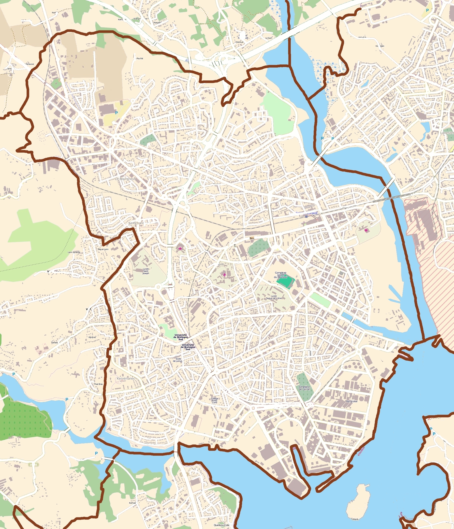
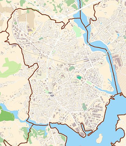
English: Map of Lorient, France
Français : carte de Lorient, France |
||||||||||||
| កាលបរិច្ឆេទ | |||||||||||||
| ប្រភព | OpenStreetMap | ||||||||||||
| អ្នកនិពន្ធ | OpenStreetMap contributors | ||||||||||||
| ការអនុញ្ញាត (ប្រើឯកសារនេះឡើងវិញ) |
|
ការដាក់អាជ្ញាប័ណ្ណ
ឯកសារនេះជាប់អាជ្ញាបណ្ឌCreative Commons Attribution-Share Alike 3.0 Unported។
- អ្នកមានសិទ្ធិ៖
- ចែកចាយ – ថតចំលងនិងចែកចាយស្នាដៃនេះ
- កែច្នៃ – កែច្នៃយកទៅប្រើ
- ក្រោមលក្ខខណ្ឌដូចតទៅនេះ៖
- ភាពជាម្ចាស់កម្មសិទ្ធ – You must give appropriate credit, provide a link to the license, and indicate if changes were made. You may do so in any reasonable manner, but not in any way that suggests the licensor endorses you or your use.
- share alike – If you remix, transform, or build upon the material, you must distribute your contributions under the same or compatible license as the original.
ប្រវត្តិឯកសារ
ចុចលើម៉ោងនិងកាលបរិច្ឆេទដើម្បីមើលឯកសារដែលបានផ្ទុកឡើងនៅពេលនោះ។
| ម៉ោងនិងកាលបរិច្ឆេទ | កូនរូបភាព | វិមាត្រ | អ្នកប្រើប្រាស់ | យោបល់ | |
|---|---|---|---|---|---|
| បច្ចុប្បន្ន | ម៉ោង១២:២៧ ថ្ងៃអង្គារ ទី២៦ ខែកក្កដា ឆ្នាំ២០១១ | | ១៨៤៧ × ២១៥២ (២.៧៣មេកាបៃ) | XIIIfromTOKYO | rem street names |
| ម៉ោង១០:១៨ ថ្ងៃអង្គារ ទី២៦ ខែកក្កដា ឆ្នាំ២០១១ |  | ១៨៤៧ × ២១៥២ (៣.០២មេកាបៃ) | XIIIfromTOKYO | {{Information |Description ={{en|1=Map of Lorient, France}} {{fr|1=carte de Lorient, France}} |Source =OpenStreetMap |Author =OpenStreetMap contributors |Date =2011-07-26 |Permission ={{OpenStreetMap}} |other_versions = }} |
បម្រើបម្រាស់ឯកសារ
ទំព័រ ខាងក្រោមប្រើប្រាស់ឯកសារនេះ ៖
បម្រើបម្រាស់ឯកសារជាសាកល
វីគីដទៃទៀតដូចខាងក្រោមនេះប្រើប្រាស់ឯកសារនេះ៖
- ការប្រើប្រាស់នៅក្នុង ar.wikipedia.org
- ការប្រើប្រាស់នៅក្នុង azb.wikipedia.org
- ការប្រើប្រាស់នៅក្នុង br.wikipedia.org
- ការប្រើប្រាស់នៅក្នុង ceb.wikipedia.org
- ការប្រើប្រាស់នៅក្នុង da.wikipedia.org
- ការប្រើប្រាស់នៅក្នុង en.wikipedia.org
- ការប្រើប្រាស់នៅក្នុង es.wikipedia.org
- ការប្រើប្រាស់នៅក្នុង fa.wikipedia.org
- ការប្រើប្រាស់នៅក្នុង fr.wikipedia.org
- Lorient
- Festival interceltique de Lorient
- Stade du Moustoir
- Keryado
- Chambre de commerce et d'industrie du Morbihan
- Base sous-marine de Lorient
- Cité de la voile Éric Tabarly
- Campus de Lanveur
- Campus de Saint-Maudé
- Centre commercial La Galerie Lanester
- Festival Les Indisciplinées
- Église Notre-Dame-de-Victoire de Lorient
- Presqu'île de Keroman
- Port de pêche de Keroman
- Modèle:Géolocalisation/Lorient
- Port de commerce de Kergroise
- Chapelle Saint-Christophe de Lorient
- Enclos du port
- Hôtel Gabriel
- Tour de la Découverte
- Pont de Kermelo
- Monument expiatoire de Lorient
- Maison (Lorient, 18 rue Jules Legrand)
- Hôpital des armées Calmette
- Île Saint-Michel
- Église Notre-Dame-de-Bonne-Nouvelle de Lorient
- Lycée Dupuy-de-Lôme
- Hôpital du Scorff
- Pont des Indes
- Château de Soye (Morbihan)
- Lycée Colbert de Lorient
- 253 cité de Soye
- Arsenal de Lorient
- SMS Regensburg
- Espace Découverte du sous-marin Flore
View more global usage of this file.