
ឯកសារ:Ukraine relief location map.jpg

ទំហំរបស់ការមើលមុននេះ: ៨០០ × ៥៣៨ ភីកសែ។ ភាពម៉ត់ផ្សេងទៀត៖ ៣២០ × ២១៥ ភីកសែ | ៦៤០ × ៤៣១ ភីកសែ | ១០២៤ × ៦៨៩ ភីកសែ | ១២៨០ × ៨៦១ ភីកសែ | ១៧២០ × ១១៥៧ ភីកសែ។
រូបភាពដើម (១៧២០ × ១១៥៧ ភីកសែល ទំហំឯកសារ៖ ១.១៤មេកាបៃ ប្រភេទ MIME៖ image/jpeg)
| ការពិពណ៌នា |
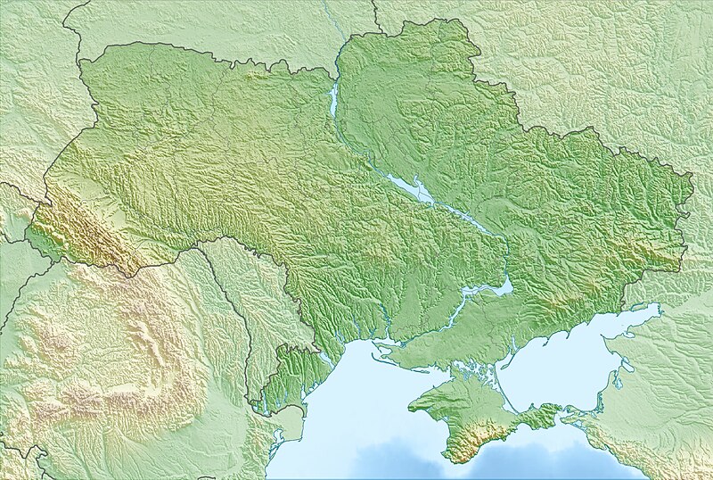
Deutsch: Physische Positionskarte der Ukraine
Quadratische Plattkarte, N-S-Streckung 150 %. Geographische Begrenzung der Karte:
English: Physical location map of Ukraine
Equirectangular projection, N/S stretching 150 %. Geographic limits of the map:
|
| កាលបរិច្ឆេទ | |
| ប្រភព | ការងារផ្ទាល់របស់អ្នកផ្ទុកឡើង, using map data from administrative map by NordNordWest. The relief was created from SRTM-30 relief data |
| អ្នកនិពន្ធ | Carport |
| ការអនុញ្ញាត (ប្រើឯកសារនេះឡើងវិញ) |
ឯកសារនេះជាប់អាជ្ញាបណ្ឌCreative Commons Attribution-Share Alike 3.0 Unported។
|
| ទំរង់ផ្សេងទៀត |
|

ប្រវត្តិឯកសារ
ចុចលើម៉ោងនិងកាលបរិច្ឆេទដើម្បីមើលឯកសារដែលបានផ្ទុកឡើងនៅពេលនោះ។
| ម៉ោងនិងកាលបរិច្ឆេទ | កូនរូបភាព | វិមាត្រ | អ្នកប្រើប្រាស់ | យោបល់ | |
|---|---|---|---|---|---|
| បច្ចុប្បន្ន | ម៉ោង១៦:២៤ ថ្ងៃសុក្រ ទី១២ ខែមីនា ឆ្នាំ២០១០ | | ១៧២០ × ១១៥៧ (១.១៤មេកាបៃ) | Carport | {{Information |Description={{de|Physische Positionskarte der {{w|Ukraine|3=de}}}} Quadratische Plattkarte, N-S-Streckung 150 %. Geographische Begrenzung der Karte: * N: 52.7° N * S: 44.1° N * W: 21.5° O * O: 40.7° O {{en|Physical location map of {{w|U |
បម្រើបម្រាស់ឯកសារ
2 ទំព័រ ខាងក្រោមប្រើប្រាស់ឯកសារនេះ ៖
បម្រើបម្រាស់ឯកសារជាសាកល
វីគីដទៃទៀតដូចខាងក្រោមនេះប្រើប្រាស់ឯកសារនេះ៖
- ការប្រើប្រាស់នៅក្នុង als.wikipedia.org
- ការប្រើប្រាស់នៅក្នុង ar.wikipedia.org
- ការប្រើប្រាស់នៅក្នុង av.wikipedia.org
- ការប្រើប្រាស់នៅក្នុង azb.wikipedia.org
- ការប្រើប្រាស់នៅក្នុង az.wikipedia.org
- Krım
- Çernobıl AES
- Şablon:Yer xəritəsi Ukrayna
- Kerç yarımadası
- Qenices boğazı
- Çonqar boğazı
- Arabat boğazı
- Dnestrovsko-Çareqradskoe qirlo
- Or bərzəxi
- Aq-Manay bərzəği
- Kerç boğazı
- Qoverla
- Zmeynıy adası
- Optimistiçeskaya mağarası
- Sınevir
- Brebeneskul
- Adalar adası
- Arabat əqrəbi
- Qılburun dili
- Aleşkov qumları
- Baqqal dili
- Belıe Kuçuqurı
- Obitoçnaya dili
- Krivaya dili
- Belosaray dili
- Tuzla dili
- Biryoçiy adası
- Fedotov dili
- Berdyan dili
- Yəşəm çimərliyi
- Massandra çimərliyi
- Müqəddəs Hadisə qayası
- Alyaud yarımadası
- Çonqar yarımadası
- Yaqorliski Kut
- Tərxan Qut yarımadası
- Litovski yarımadası
- İqren yarımadası
View more global usage of this file.