
ឯកសារ:Colonisation2.gif

រូបភាពដើម (១៨៤៩ × ៨១០ ភីកសែល ទំហំឯកសារ៖ ២.០៨មេកាបៃ ប្រភេទ MIME៖ image/gif, រង្វិល, ១២ ផ្ទាំង, ៤៨វិ.)
ចំណារពន្យល់
| ការពិពណ៌នា |
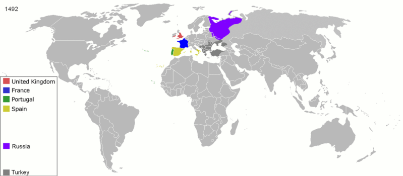
English: Map indicating the territories colonized by the European powers, United States and Japan.
Русский: Карта с указанием территорий, колонизированных Европейскими державами, Соединёнными штатами и Японией.
|
||||||||||||||||
| កាលបរិច្ឆេទ | ២៣ ខែមិថុនា ២០០៨ (original upload date) | ||||||||||||||||
| ប្រភព | Transferred from en.wikipedia to Commons. | ||||||||||||||||
| អ្នកនិពន្ធ | ArdadN at អង់គ្លេស វិគីភីឌា | ||||||||||||||||
| ទំរង់ផ្សេងទៀត |
The maps can be seen separately by using this template:
Derivative works of this file: |
||||||||||||||||
.gif)
.jpg)
._LOC_2001620596.jpg)
ការដាក់អាជ្ញាប័ណ្ណ
| I, the copyright holder of this work, release this work into the public domain. This applies worldwide. In some countries this may not be legally possible; if so: I grant anyone the right to use this work for any purpose, without any conditions, unless such conditions are required by law. |
ប្រវត្តិឯកសារ
ចុចលើម៉ោងនិងកាលបរិច្ឆេទដើម្បីមើលឯកសារដែលបានផ្ទុកឡើងនៅពេលនោះ។
| ម៉ោងនិងកាលបរិច្ឆេទ | កូនរូបភាព | វិមាត្រ | អ្នកប្រើប្រាស់ | យោបល់ | |
|---|---|---|---|---|---|
| បច្ចុប្បន្ន | ម៉ោង១៥:៤០ ថ្ងៃច័ន្ទ ទី០៥ ខែតុលា ឆ្នាំ២០២០ | | ១៨៤៩ × ៨១០ (២.០៨មេកាបៃ) | Ориенталист | Colour correction |
| ម៉ោង១៤:១៩ ថ្ងៃអាទិត្យ ទី១០ ខែឧសភា ឆ្នាំ២០២០ |  | ៨០០ × ៣៧៩ (៦០៦គីឡូបៃ) | Ориенталист | Cosmetic changes | |
| ម៉ោង០៩:៣៩ ថ្ងៃអាទិត្យ ទី០៥ ខែមេសា ឆ្នាំ២០២០ |  | ៨០០ × ៣៥១ (៥៦១គីឡូបៃ) | Ориенталист | Last time i forgot 1914. Аdded it, little changes | |
| ម៉ោង០៩:៤៩ ថ្ងៃសៅរ៍ ទី០៤ ខែមេសា ឆ្នាំ២០២០ |  | ៨០០ × ៣៥១ (៤៩៥គីឡូបៃ) | Ориенталист | Changed maps for 1492, 1550, 1660, 1754. Added a map for 1600. | |
| ម៉ោង១១:២៩ ថ្ងៃពុធ ទី០៩ ខែមករា ឆ្នាំ២០១៩ |  | ១៤២៥ × ៦២៥ (១០១គីឡូបៃ) | ArdadN | fixed Ireland 1754, Morocco 1914, Russian-German border 1885 and 1914, German-French border 1885 and 1914, German-Danish border 1885, Austria and Sudetenland 1938 | |
| ម៉ោង០៨:៥៤ ថ្ងៃច័ន្ទ ទី២៣ ខែកក្កដា ឆ្នាំ២០១៨ |  | ១៤២៥ × ៦២៥ (១០១គីឡូបៃ) | SuperSucker | fix - believe in 1938 ethiopia was under european occupation as well.. italy had taken the capital Addis-Abeba in 1936 indeed | |
| ម៉ោង២០:២៧ ថ្ងៃច័ន្ទ ទី០៤ ខែមិថុនា ឆ្នាំ២០១២ |  | ១៤២៥ × ៦២៥ (១០១គីឡូបៃ) | Mnlk | i corrected the error that falsly depicted ethiopia as colony of fascist italy | |
| ម៉ោង១៩:៤៩ ថ្ងៃសៅរ៍ ទី១៩ ខែកុម្ភៈ ឆ្នាំ២០១១ |  | ១៤២៥ × ៦២៥ (២៤៦គីឡូបៃ) | NordNordWest | corrected according to http://de.wikipedia.org/w/index.php?title=Benutzer_Diskussion%3ANordNordWest&action=historysubmit&diff=85468547&oldid=85447379 | |
| ម៉ោង១៩:៤០ ថ្ងៃសុក្រ ទី១៨ ខែកុម្ភៈ ឆ្នាំ២០១១ |  | ១៤២៥ × ៦២៥ (២៣៦គីឡូបៃ) | NordNordWest | corrected according to http://de.wikipedia.org/w/index.php?title=Benutzer_Diskussion%3ANordNordWest&action=historysubmit&diff=85447379&oldid=85351900 | |
| ម៉ោង១៩:៤២ ថ្ងៃព្រហស្បតិ៍ ទី១៦ ខែកញ្ញា ឆ្នាំ២០១០ |  | ១៤២៥ × ៦២៥ (២៥៧គីឡូបៃ) | NordNordWest | further corrections |
បម្រើបម្រាស់ឯកសារ
គ្មានទំព័រណាមួយដែលប្រើប្រាស់ឯកសារនេះទេ។
បម្រើបម្រាស់ឯកសារជាសាកល
វីគីដទៃទៀតដូចខាងក្រោមនេះប្រើប្រាស់ឯកសារនេះ៖
- ការប្រើប្រាស់នៅក្នុង ar.wikipedia.org
- ការប្រើប្រាស់នៅក្នុង av.wikipedia.org
- ការប្រើប្រាស់នៅក្នុង azb.wikipedia.org
- ការប្រើប្រាស់នៅក្នុង az.wikipedia.org
- ការប្រើប្រាស់នៅក្នុង ba.wikipedia.org
- ការប្រើប្រាស់នៅក្នុង be-tarask.wikipedia.org
- ការប្រើប្រាស់នៅក្នុង be.wikipedia.org
- ការប្រើប្រាស់នៅក្នុង bg.wikipedia.org
- ការប្រើប្រាស់នៅក្នុង bn.wikipedia.org
- ការប្រើប្រាស់នៅក្នុង ce.wikipedia.org
- ការប្រើប្រាស់នៅក្នុង cs.wikipedia.org
- ការប្រើប្រាស់នៅក្នុង da.wikipedia.org
- ការប្រើប្រាស់នៅក្នុង de.wikipedia.org
- ការប្រើប្រាស់នៅក្នុង diq.wikipedia.org
- ការប្រើប្រាស់នៅក្នុង en.wikipedia.org
- History of Europe
- Early modern period
- Maritime history
- Colonial empire
- History of colonialism
- User:Palaeovia
- Portal:Maps/Maps/World
- Portal:Maps/Maps/World/18
- History of globalization
- User talk:AtomAtom
- Western world
- User:Meclee/proj4-sandbox
- User:Kazkaskazkasako/Books/History
- Outline of globalization
- Decoloniality
- Wikipedia:Graphics Lab/Map workshop/Archive/Apr 2014
- User:Bongan
- User:Bongan/genetic history of the human race
- ការប្រើប្រាស់នៅក្នុង en.wikibooks.org
View more global usage of this file.