
ឯកសារ:East Timor location map 2003-2015.svg

Size of this PNG preview of this SVG file: ៨០០ × ៤៨៩ ភីកសែ. ភាពម៉ត់ផ្សេងទៀត៖ ៣២០ × ១៩៦ ភីកសែ | ៦៤០ × ៣៩១ ភីកសែ | ១០២៤ × ៦២៦ ភីកសែ | ១២៨០ × ៧៨៣ ភីកសែ | ២៥៦០ × ១៥៦៥ ភីកសែ | ១៧០១ × ១០៤០ ភីកសែ។
រូបភាពដើម (ឯកសារប្រភេទSVG ១៧០១ × ១០៤០ ភីកសែល ទំហំឯកសារ៖ ២០១គីឡូបៃ)
ចំណារពន្យល់
| ការពិពណ៌នា |
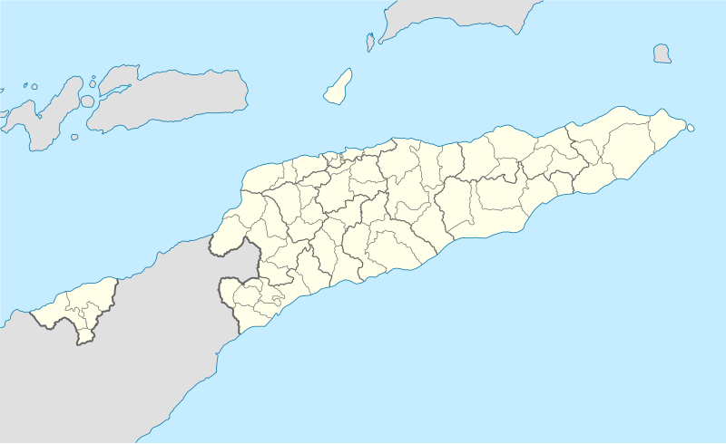
Deutsch: Positionskarte von Osttimor, Grenzen von 2003–2015
Quadratische Plattkarte. Geographische Begrenzung der Karte:
English: Location map of East Timor
Equirectangular projection. Geographic limits of the map:
|
||
| កាលបរិច្ឆេទ | |||
| ប្រភព |
ការងារផ្ទាល់របស់អ្នកផ្ទុកឡើង using
|
||
| អ្នកនិពន្ធ | NordNordWest | ||
| ទំរង់ផ្សេងទៀត |
East Timor relief location map.jpg:  Equivalent physical map Equivalent physical map |
||
| SVG genesis | រូបភាពក្រាភិកវ៉ិចទ័រនេះត្រូវបានបង្កើតឡើងដោយប្រើ Inkscape, or with something else.
|

ការដាក់អាជ្ញាប័ណ្ណ
I, the copyright holder of this work, hereby publish it under the following licenses:

|
រូបភាពនៃទំព័រនេះជាកម្មសិទ្ធិរបស់GNU Free Documentation License។ Version 1.2 ឬក៏ខ្ពស់ជាងនេះត្រូវបានឧបត្ថមគាំទ្រដោយ មូលនិធិសូហ្វវែរដោយឥតគិតថ្លៃ (Free Software Foundation) ដែលមិនមានផ្នែកណាមួយរបស់ប្រភពដើមរួមទាំងអក្សរនៅលើគំរបមុខនិងខ្នង ត្រូវបានផ្លាស់ប្តូរទេ។ ចំពោះផ្នែកដែលមិនអាចផ្លាស់ប្តូរបាន សូមមើលGNU Free Documentation License។ |
ឯកសារនេះជាប់អាជ្ញាបណ្ឌCreative Commons Attribution 3.0 Unported។
- អ្នកមានសិទ្ធិ៖
- ចែកចាយ – ថតចំលងនិងចែកចាយស្នាដៃនេះ
- កែច្នៃ – កែច្នៃយកទៅប្រើ
- ក្រោមលក្ខខណ្ឌដូចតទៅនេះ៖
- ភាពជាម្ចាស់កម្មសិទ្ធ – You must give appropriate credit, provide a link to the license, and indicate if changes were made. You may do so in any reasonable manner, but not in any way that suggests the licensor endorses you or your use.
You may select the license of your choice.
ប្រវត្តិឯកសារ
ចុចលើម៉ោងនិងកាលបរិច្ឆេទដើម្បីមើលឯកសារដែលបានផ្ទុកឡើងនៅពេលនោះ។
| ម៉ោងនិងកាលបរិច្ឆេទ | កូនរូបភាព | វិមាត្រ | អ្នកប្រើប្រាស់ | យោបល់ | |
|---|---|---|---|---|---|
| បច្ចុប្បន្ន | ម៉ោង១៦:១៧ ថ្ងៃពុធ ទី២៧ ខែឧសភា ឆ្នាំ២០០៩ | | ១៧០១ × ១០៤០ (២០១គីឡូបៃ) | NordNordWest | completed |
| ម៉ោង១៦:១៩ ថ្ងៃច័ន្ទ ទី២៥ ខែឧសភា ឆ្នាំ២០០៩ |  | ១៧០១ × ១០៤០ (១២៦គីឡូបៃ) | NordNordWest | c | |
| ម៉ោង១៦:១១ ថ្ងៃច័ន្ទ ទី២៥ ខែឧសភា ឆ្នាំ២០០៩ |  | ១៧០១ × ១០៤០ (១២៦គីឡូបៃ) | NordNordWest | {{Information |Description= {{de|Positionskarte von Osttimor}} Quadratische Plattkarte. Geographische Begrenzung der Karte: * N: 7.8° S * S: 10.0° S * W: 123.9° O * O: 127.5° O {{en|Location map of East Timor}} Equi |
បម្រើបម្រាស់ឯកសារ
គ្មានទំព័រណាមួយដែលប្រើប្រាស់ឯកសារនេះទេ។
បម្រើបម្រាស់ឯកសារជាសាកល
វីគីដទៃទៀតដូចខាងក្រោមនេះប្រើប្រាស់ឯកសារនេះ៖
- ការប្រើប្រាស់នៅក្នុង bn.wikipedia.org
- ការប្រើប្រាស់នៅក្នុង de.wikipedia.org
- ការប្រើប្រាស់នៅក្នុង es.wikipedia.org
- ការប្រើប្រាស់នៅក្នុង fr.wikinews.org
- ការប្រើប្រាស់នៅក្នុង ia.wikipedia.org
- ការប្រើប្រាស់នៅក្នុង incubator.wikimedia.org
- ការប្រើប្រាស់នៅក្នុង pt.wikipedia.org
- ការប្រើប្រាស់នៅក្នុង www.wikidata.org