
ឯកសារ:Indochina map 1886.jpg

រូបភាពដើម (១៦២៦ × ២១១៤ ភីកសែល ទំហំឯកសារ៖ ៥៣៣គីឡូបៃ ប្រភេទ MIME៖ image/jpeg)
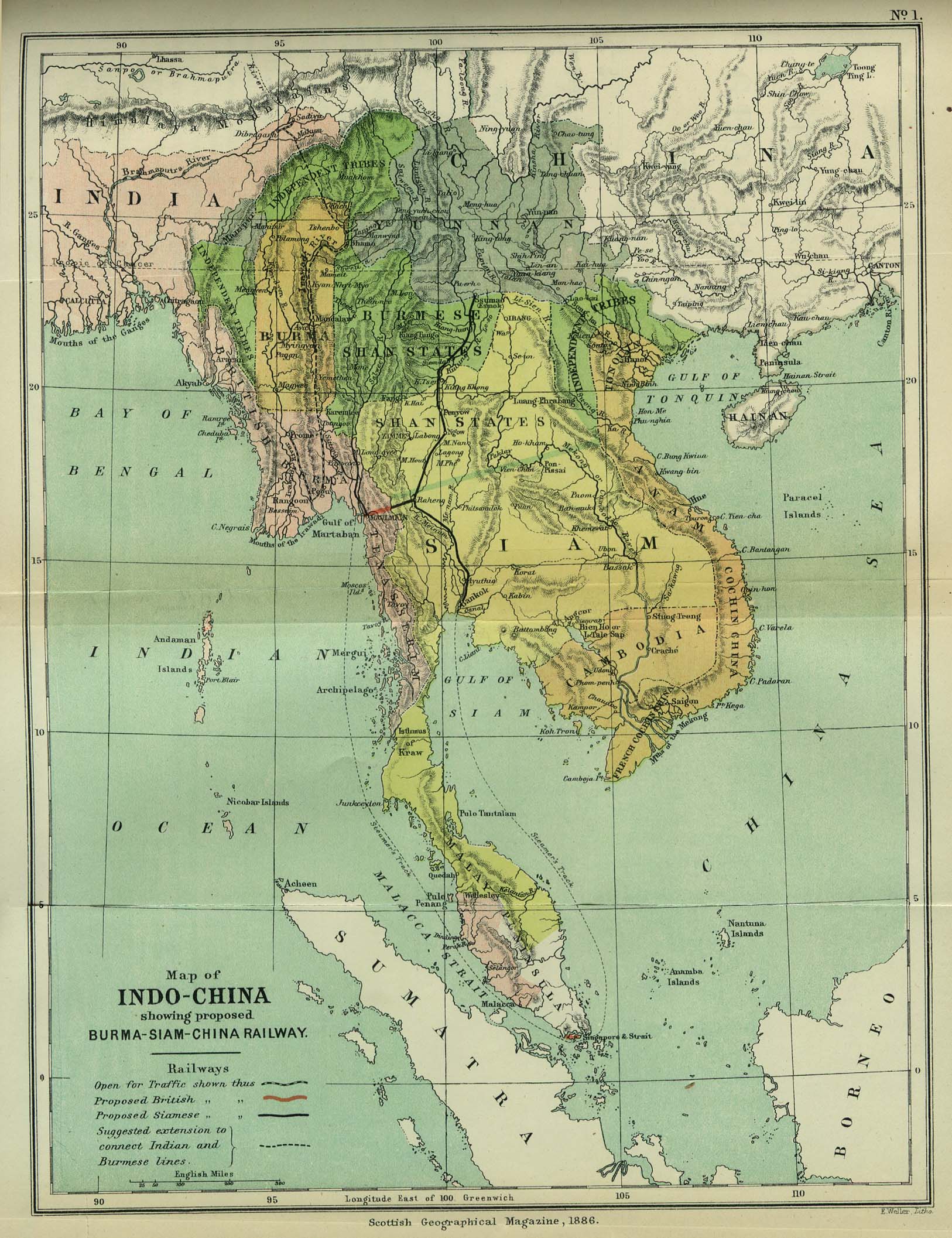
| ការពិពណ៌នា | Map of Indochina | ||||
| កាលបរិច្ឆេទ | |||||
| ប្រភព | http://www.lib.utexas.edu/maps/cambodia.html (http://www.lib.utexas.edu/maps/historical/indo_china_1886.jpg); Scottish Geographical Magazine (Volume II) | ||||
| អ្នកនិពន្ធ | Scottish Geographical Magazine and edited by Hugh A. Webster and Arthur Silva White | ||||
| ការអនុញ្ញាត (ប្រើឯកសារនេះឡើងវិញ) |
|
||||
| ទំរង់ផ្សេងទៀត | File:IndoChina1886.jpg | ||||
ប្រវត្តិឯកសារ
ចុចលើម៉ោងនិងកាលបរិច្ឆេទដើម្បីមើលឯកសារដែលបានផ្ទុកឡើងនៅពេលនោះ។
| ម៉ោងនិងកាលបរិច្ឆេទ | កូនរូបភាព | វិមាត្រ | អ្នកប្រើប្រាស់ | យោបល់ | |
|---|---|---|---|---|---|
| បច្ចុប្បន្ន | ម៉ោង០២:៥៦ ថ្ងៃសុក្រ ទី០២ ខែឧសភា ឆ្នាំ២០០៨ | | ១៦២៦ × ២១១៤ (៥៣៣គីឡូបៃ) | Calliopejen1 | {{Information |Description=Map of French Indochina |Source=http://www.lib.utexas.edu/maps/cambodia.html (http://www.lib.utexas.edu/maps/historical/indo_china_1886.jpg) |Date=1886 |Author=Scottish Geographical Magazine |Permission={{PD-old}} |other_version |
បម្រើបម្រាស់ឯកសារ
គ្មានទំព័រណាមួយដែលប្រើប្រាស់ឯកសារនេះទេ។
បម្រើបម្រាស់ឯកសារជាសាកល
វីគីដទៃទៀតដូចខាងក្រោមនេះប្រើប្រាស់ឯកសារនេះ៖
- ការប្រើប្រាស់នៅក្នុង bcl.wikipedia.org
- ការប្រើប្រាស់នៅក្នុង el.wikipedia.org
- ការប្រើប្រាស់នៅក្នុង en.wikipedia.org
- ការប្រើប្រាស់នៅក្នុង en.wikiversity.org
- ការប្រើប្រាស់នៅក្នុង fi.wikipedia.org
- ការប្រើប្រាស់នៅក្នុង got.wikipedia.org
- ការប្រើប្រាស់នៅក្នុង kn.wikipedia.org
- ការប្រើប្រាស់នៅក្នុង ms.wikipedia.org
- ការប្រើប្រាស់នៅក្នុង pa.wikipedia.org
- ការប្រើប្រាស់នៅក្នុង sl.wikipedia.org
- ការប្រើប្រាស់នៅក្នុង uz.wikipedia.org