
ឯកសារ:Openstreetmap mapping streets with family on el hierro island.jpg

ទំហំរបស់ការមើលមុននេះ: ៤០៧ × ៥៩៩ ភីកសែ។ ភាពម៉ត់ផ្សេងទៀត៖ ១៦៣ × ២៤០ ភីកសែ | ៣២៦ × ៤៨០ ភីកសែ | ៥២២ × ៧៦៨ ភីកសែ | ៦៩៦ × ១០២៤ ភីកសែ | ១៩៤៤ × ២៨៦០ ភីកសែ។
រូបភាពដើម (១៩៤៤ × ២៨៦០ ភីកសែល ទំហំឯកសារ៖ ១.២មេកាបៃ ប្រភេទ MIME៖ image/jpeg)

|
The uploader asserts the following regarding consent of identifiable persons: I personally created this media. All identifiable persons shown specifically consented to publication of this photograph or video. |
ចំណារពន្យល់
| ការពិពណ៌នា |
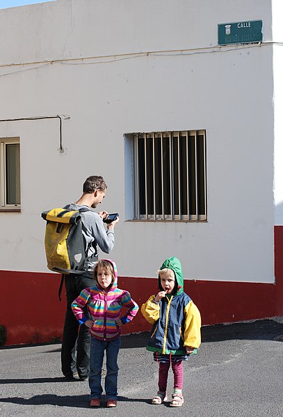
English: Mapping streets for Openstreetmap on a family getaway on El Hierro island. (Street sign identifies location as Calle Montaña Aguarijo, Valverde, El Hierro island, Santa Cruz province, Canary Islands, Spain.)
Deutsch: Straßen für Openstreetmap während eines Familienausflugs auf der Insel El Hierro kartieren. |
| កាលបរិច្ឆេទ | |
| ប្រភព | ការងារផ្ទាល់របស់អ្នកផ្ទុកឡើង |
| អ្នកនិពន្ធ | Erik Streb |
| ទីតាំងម៉ាស៊ីនថត | | រូបភាពនេះនិងរូបភាពផ្សេងទៀតនៅឯទីតាំងរបស់វាលើ: OpenStreetMap |
|---|
ការដាក់អាជ្ញាប័ណ្ណ
I, the copyright holder of this work, hereby publish it under the following licenses:

|
រូបភាពនៃទំព័រនេះជាកម្មសិទ្ធិរបស់GNU Free Documentation License។ Version 1.2 ឬក៏ខ្ពស់ជាងនេះត្រូវបានឧបត្ថមគាំទ្រដោយ មូលនិធិសូហ្វវែរដោយឥតគិតថ្លៃ (Free Software Foundation) ដែលមិនមានផ្នែកណាមួយរបស់ប្រភពដើមរួមទាំងអក្សរនៅលើគំរបមុខនិងខ្នង ត្រូវបានផ្លាស់ប្តូរទេ។ ចំពោះផ្នែកដែលមិនអាចផ្លាស់ប្តូរបាន សូមមើលGNU Free Documentation License។ |
ឯកសារនេះជាប់អាជ្ញាបណ្ឌCreative Commons Attribution-Share Alike 3.0 Unported។
- អ្នកមានសិទ្ធិ៖
- ចែកចាយ – ថតចំលងនិងចែកចាយស្នាដៃនេះ
- កែច្នៃ – កែច្នៃយកទៅប្រើ
- ក្រោមលក្ខខណ្ឌដូចតទៅនេះ៖
- ភាពជាម្ចាស់កម្មសិទ្ធ – You must give appropriate credit, provide a link to the license, and indicate if changes were made. You may do so in any reasonable manner, but not in any way that suggests the licensor endorses you or your use.
- share alike – If you remix, transform, or build upon the material, you must distribute your contributions under the same or compatible license as the original.
You may select the license of your choice.
ប្រវត្តិឯកសារ
ចុចលើម៉ោងនិងកាលបរិច្ឆេទដើម្បីមើលឯកសារដែលបានផ្ទុកឡើងនៅពេលនោះ។
| ម៉ោងនិងកាលបរិច្ឆេទ | កូនរូបភាព | វិមាត្រ | អ្នកប្រើប្រាស់ | យោបល់ | |
|---|---|---|---|---|---|
| បច្ចុប្បន្ន | ម៉ោង១៨:០៩ ថ្ងៃអង្គារ ទី៣១ ខែមករា ឆ្នាំ២០១២ | | ១៩៤៤ × ២៨៦០ (១.២មេកាបៃ) | Erik del Toro Streb | {{Information |Description ={{en|1=Mapping streets for Openstreetmap on a family getaway on El Hierro island.}} {{de|1=Straßen für Openstreetmap während eines Familienausflugs auf der Ins |
បម្រើបម្រាស់ឯកសារ
ទំព័រ ខាងក្រោមប្រើប្រាស់ឯកសារនេះ ៖
បម្រើបម្រាស់ឯកសារជាសាកល
វីគីដទៃទៀតដូចខាងក្រោមនេះប្រើប្រាស់ឯកសារនេះ៖
- ការប្រើប្រាស់នៅក្នុង es.wikipedia.org