
ឯកសារ:Somerset UK relief location map.jpg

ទំហំរបស់ការមើលមុននេះ: ៨០០ × ៥០៥ ភីកសែ។ ភាពម៉ត់ផ្សេងទៀត៖ ៣២០ × ២០២ ភីកសែ | ៦៤០ × ៤០៤ ភីកសែ | ១០២៤ × ៦៤៧ ភីកសែ | ១២៨០ × ៨០៨ ភីកសែ | ២០១៩ × ១២៧៥ ភីកសែ។
រូបភាពដើម (២០១៩ × ១២៧៥ ភីកសែល ទំហំឯកសារ៖ ៣៦៧គីឡូបៃ ប្រភេទ MIME៖ image/jpeg)
| ការពិពណ៌នា |
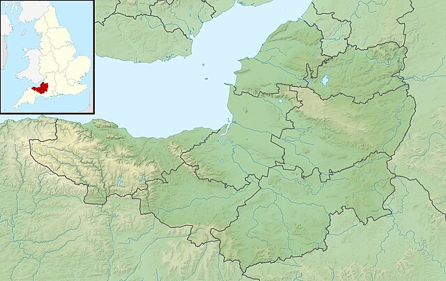
Relief map of Somerset, UK. Equirectangular map projection on WGS 84 datum, with N/S stretched 155% Geographic limits:
|
| កាលបរិច្ឆេទ | |
| ប្រភព |
|
| អ្នកនិពន្ធ | Nilfanion, created using Ordnance Survey data |
| ការអនុញ្ញាត (ប្រើឯកសារនេះឡើងវិញ) |
ឯកសារនេះជាប់អាជ្ញាបណ្ឌCreative Commons Attribution-Share Alike 3.0 Unported។ ភាពជាម្ចាស់កម្មសិទ្ធ: Contains Ordnance Survey data © Crown copyright and database right
|
| ទំរង់ផ្សេងទៀត | File:Somerset UK district map (blank).svg - Blank map |
.svg)
ប្រវត្តិឯកសារ
ចុចលើម៉ោងនិងកាលបរិច្ឆេទដើម្បីមើលឯកសារដែលបានផ្ទុកឡើងនៅពេលនោះ។
| ម៉ោងនិងកាលបរិច្ឆេទ | កូនរូបភាព | វិមាត្រ | អ្នកប្រើប្រាស់ | យោបល់ | |
|---|---|---|---|---|---|
| បច្ចុប្បន្ន | ម៉ោង០១:៥៣ ថ្ងៃអង្គារ ទី២៩ ខែវិច្ឆិកា ឆ្នាំ២០១១ | | ២០១៩ × ១២៧៥ (៣៦៧គីឡូបៃ) | Nilfanion | {{Information |Description=Relief map of Somerset, UK. Equirectangular map projection on WGS 84 datum, with N/S stretched 155% Geographic limits: *West: 3.96W *East: 2.12W *North: 51.55N *South: 50.80N |Source=[[w:Ordnance Survey|Ordnance |
បម្រើបម្រាស់ឯកសារ
ទំព័រ ខាងក្រោមប្រើប្រាស់ឯកសារនេះ ៖
បម្រើបម្រាស់ឯកសារជាសាកល
វីគីដទៃទៀតដូចខាងក្រោមនេះប្រើប្រាស់ឯកសារនេះ៖
- ការប្រើប្រាស់នៅក្នុង ar.wikipedia.org
- ការប្រើប្រាស់នៅក្នុង arz.wikipedia.org
- ការប្រើប្រាស់នៅក្នុង bg.wikipedia.org
- ការប្រើប្រាស់នៅក្នុង bn.wikipedia.org
- ការប្រើប្រាស់នៅក្នុង ceb.wikipedia.org
- ការប្រើប្រាស់នៅក្នុង en.wikipedia.org
- Battle of Lansdowne
- Battle of Sedgemoor
- River Tone
- Chew Valley Lake
- Hunstrete Lake
- Orchardleigh Lake
- Battle of Langport
- Cheddar Reservoir
- Blagdon Lake
- Litton Reservoirs
- Chew Magna Reservoir
- Emborough
- Wimbleball Lake
- Ashford Reservoir
- River Cam (Somerset)
- Clatworthy Reservoir
- Durleigh reservoir
- Buildings and architecture of Bath
- Ham Wall
- Knowle Hill
- Weston-super-Mare Lifeboat Station
- Chard Reservoir
- Hawkridge Reservoir
- Sutton Bingham Reservoir
- Otterhead Lakes
- Minehead Lifeboat Station
- Burnham-on-Sea Lifeboat Station
- Burnham Area Rescue Boat
- Brent Knoll
- Luxhay Reservoir
View more global usage of this file.