
ឯកសារ:Philippines location map (Mindanao).svg

Size of this PNG preview of this SVG file: ៦៥៦ × ៤៨៦ ភីកសែ. ភាពម៉ត់ផ្សេងទៀត៖ ៣២០ × ២៣៧ ភីកសែ | ៦៤០ × ៤៧៤ ភីកសែ | ១០២៤ × ៧៥៩ ភីកសែ | ១២៨០ × ៩៤៨ ភីកសែ | ២៥៦០ × ១៨៩៧ ភីកសែ។
រូបភាពដើម (ឯកសារប្រភេទSVG ៦៥៦ × ៤៨៦ ភីកសែល ទំហំឯកសារ៖ ៣.៦៦មេកាបៃ)
.svg)
ចំណារពន្យល់
| ការពិពណ៌នា |
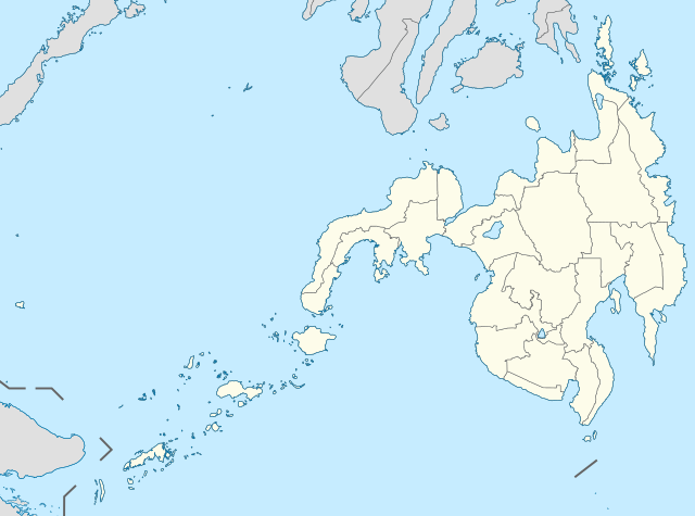
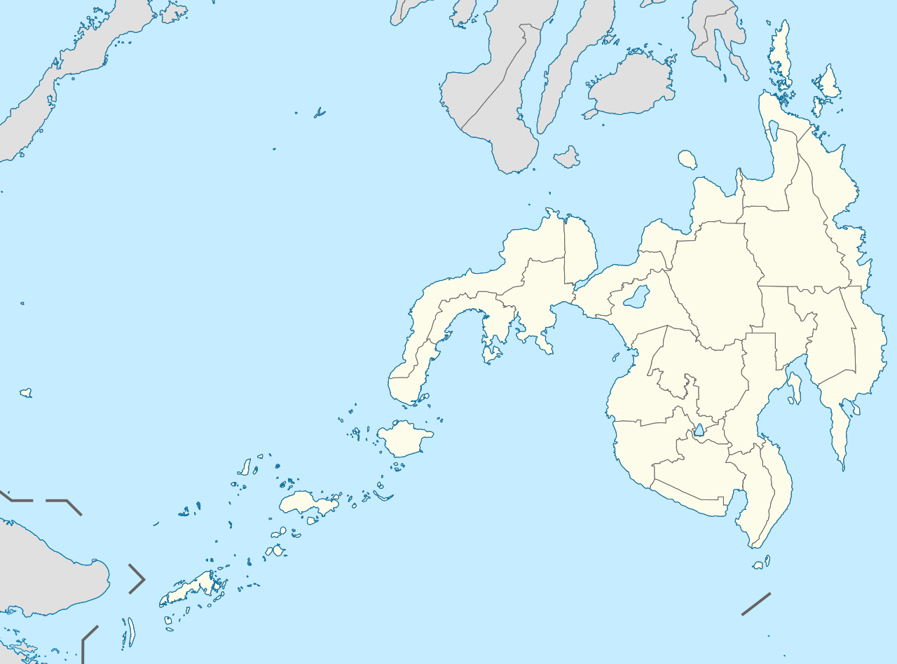
English: Location map of the Philippines (Mindanao)
Equirectangular projection based on the parallel of 10°43' N
|
| កាលបរិច្ឆេទ | |
| ប្រភព | File:Philippines location map (square).svg |
| អ្នកនិពន្ធ | User:Hellerick |
| ទំរង់ផ្សេងទៀត |
This file was derived from: Philippines location map (square).svg: .svg) |
ការដាក់អាជ្ញាប័ណ្ណ
ឯកសារនេះជាប់អាជ្ញាបណ្ឌCreative Commons Attribution-Share Alike 3.0 Unported។
- អ្នកមានសិទ្ធិ៖
- ចែកចាយ – ថតចំលងនិងចែកចាយស្នាដៃនេះ
- កែច្នៃ – កែច្នៃយកទៅប្រើ
- ក្រោមលក្ខខណ្ឌដូចតទៅនេះ៖
- ភាពជាម្ចាស់កម្មសិទ្ធ – You must give appropriate credit, provide a link to the license, and indicate if changes were made. You may do so in any reasonable manner, but not in any way that suggests the licensor endorses you or your use.
- share alike – If you remix, transform, or build upon the material, you must distribute your contributions under the same or compatible license as the original.
ប្រវត្តិឯកសារ
ចុចលើម៉ោងនិងកាលបរិច្ឆេទដើម្បីមើលឯកសារដែលបានផ្ទុកឡើងនៅពេលនោះ។
| ម៉ោងនិងកាលបរិច្ឆេទ | កូនរូបភាព | វិមាត្រ | អ្នកប្រើប្រាស់ | យោបល់ | |
|---|---|---|---|---|---|
| បច្ចុប្បន្ន | ម៉ោង០៧:១១ ថ្ងៃច័ន្ទ ទី១៧ ខែឧសភា ឆ្នាំ២០២១ | | ៦៥៦ × ៤៨៦ (៣.៦៦មេកាបៃ) | Petriolo | Reverted to version as of 05:35, 3 May 2021 (UTC) The new administrative borders are based from the Philippine government websites (https://www.geoportal.gov.ph/; http://noah.up.edu.ph/), and is deemed accurate. These new files have reliable sources and there's no "beauty" in it if it is inaccurate in the first place. |
| ម៉ោង១៤:០២ ថ្ងៃអាទិត្យ ទី១៦ ខែឧសភា ឆ្នាំ២០២១ |  | ៦៥៦ × ៤៨៦ (២.២២មេកាបៃ) | AichiWikiFixer | Reverted to version as of 14:34, 27 October 2017 (UTC) (Borders seen as ugly) | |
| ម៉ោង០៥:៣៥ ថ្ងៃច័ន្ទ ទី០៣ ខែឧសភា ឆ្នាំ២០២១ |  | ៦៥៦ × ៤៨៦ (៣.៦៦មេកាបៃ) | Petriolo | updated with NAMRIA borders | |
| ម៉ោង១៤:៣៤ ថ្ងៃសុក្រ ទី២៧ ខែតុលា ឆ្នាំ២០១៧ |  | ៦៥៦ × ៤៨៦ (២.២២មេកាបៃ) | Mliu92 | Changed crop to add missing island. | |
| ម៉ោង១៧:២៣ ថ្ងៃព្រហស្បតិ៍ ទី២៦ ខែតុលា ឆ្នាំ២០១៧ |  | ៥៧៣ × ៥៧៣ (២.២២មេកាបៃ) | Mliu92 | User created page with UploadWizard |
បម្រើបម្រាស់ឯកសារ
គ្មានទំព័រណាមួយដែលប្រើប្រាស់ឯកសារនេះទេ។
បម្រើបម្រាស់ឯកសារជាសាកល
វីគីដទៃទៀតដូចខាងក្រោមនេះប្រើប្រាស់ឯកសារនេះ៖
- ការប្រើប្រាស់នៅក្នុង azb.wikipedia.org
- ការប្រើប្រាស់នៅក្នុង en.wikipedia.org
- Xavier University – Ateneo de Cagayan
- Moro Gulf
- Mindanao State University
- Ateneo de Davao University
- Francisco Bangoy International Airport
- Agusan del Sur State University
- Zamboanga International Airport
- Dipolog Airport
- Laguindingan Airport
- General Santos International Airport
- Cotabato Airport
- Pagadian Airport
- Surigao Airport
- Bancasi Airport
- Sanga-Sanga Airport
- Sayak Airport
- Bukidnon State University
- Mindanao State University–Iligan Institute of Technology
- La Salle University (Ozamiz)
- Mountain View College (Philippines)
- De La Salle John Bosco College
- Central Mindanao University
- University of the Philippines Mindanao
- Iligan Medical Center College
- Camiguin Airport
- Jolo Airport
- Labo Airport
- Father Saturnino Urios University
- Notre Dame of Marbel University
- Notre Dame of Dadiangas University
- Caraga State University – Cabadbaran Campus
- Fort Pilar
- Mindanao State University–Naawan
- University of Science and Technology of Southern Philippines
- Liceo de Cagayan University
- Cagayan de Oro College
- Misamis University
- San Pedro College
- University of the Immaculate Conception
- Assumption College of Davao
- Basilan State College
- 1976 Moro Gulf earthquake
- St. Michael's College (Iligan)
- University of Mindanao
- Saint Michael College of Caraga
- Colegio de Kidapawan
- List of Philippine Basketball Association playing venues
- Holy Cross of Davao College
- San Agustin Institute of Technology
View more global usage of this file.
.svg)
.svg)