
ឯកសារ:Kazakhstan location map.svg

រូបភាពដើម (ឯកសារប្រភេទSVG ១៩៨៤ × ១១៣៤ ភីកសែល ទំហំឯកសារ៖ ៦៣៤គីឡូបៃ)
ចំណារពន្យល់
| ការពិពណ៌នា |
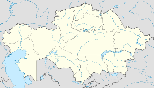
Deutsch: Positionskarte von Kasachstan
Quadratische Plattkarte, N-S-Streckung 150 %. Geographische Begrenzung der Karte:
English: Location map of Kazakhstan
Equirectangular projection, N/S stretching 150 %. Geographic limits of the map:
|
|
| កាលបរិច្ឆេទ | ||
| ប្រភព |
ការងារផ្ទាល់របស់អ្នកផ្ទុកឡើង, using
|
|
| អ្នកនិពន្ធ | NordNordWest | |
| ការអនុញ្ញាត (ប្រើឯកសារនេះឡើងវិញ) |
ឯកសារនេះជាប់អាជ្ញាបណ្ឌCreative Commons Attribution-Share Alike 3.0 Germany។
 ឯកសារនេះជាប់អាជ្ញាបណ្ឌCreative Commons Attribution-Share Alike 3.0 Germany។
|


|
This map has been made or improved in the German Kartenwerkstatt (Map Lab). You can propose maps to improve as well.
|
ប្រវត្តិឯកសារ
ចុចលើម៉ោងនិងកាលបរិច្ឆេទដើម្បីមើលឯកសារដែលបានផ្ទុកឡើងនៅពេលនោះ។
| ម៉ោងនិងកាលបរិច្ឆេទ | កូនរូបភាព | វិមាត្រ | អ្នកប្រើប្រាស់ | យោបល់ | |
|---|---|---|---|---|---|
| បច្ចុប្បន្ន | ម៉ោង១៨:៤៨ ថ្ងៃអាទិត្យ ទី០១ ខែសីហា ឆ្នាំ២០១០ | | ១៩៨៤ × ១១៣៤ (៦៣៤គីឡូបៃ) | NordNordWest | upd |
| ម៉ោង១៩:១៥ ថ្ងៃសុក្រ ទី២៧ ខែវិច្ឆិកា ឆ្នាំ២០០៩ |  | ១៩៨៥ × ១១៣៤ (៩៤៩គីឡូបៃ) | NordNordWest | c | |
| ម៉ោង១២:៤២ ថ្ងៃអង្គារ ទី២៤ ខែវិច្ឆិកា ឆ្នាំ២០០៩ |  | ១៩៨៤ × ១១៣៤ (៩៤២គីឡូបៃ) | NordNordWest | c | |
| ម៉ោង១២:៣៨ ថ្ងៃអង្គារ ទី២៤ ខែវិច្ឆិកា ឆ្នាំ២០០៩ |  | ១៩៨៥ × ១១៣៤ (៩៤១គីឡូបៃ) | NordNordWest | ||
| ម៉ោង១៨:៤១ ថ្ងៃច័ន្ទ ទី២៣ ខែវិច្ឆិកា ឆ្នាំ២០០៩ |  | ១៩៨៥ × ១១៣៤ (៥១៦គីឡូបៃ) | NordNordWest | =={{int:filedesc}}== {{Information |Description= {{de|Positionskarte von Kasachstan, '''Vorversion'''}} Quadratische Plattkarte, N-S-Streckung 150 %. Geographische Begrenzung der Karte: * N: 56° N * S: 40° N * W: 46° O * O: 88° O {{ |
បម្រើបម្រាស់ឯកសារ
គ្មានទំព័រណាមួយដែលប្រើប្រាស់ឯកសារនេះទេ។
បម្រើបម្រាស់ឯកសារជាសាកល
វីគីដទៃទៀតដូចខាងក្រោមនេះប្រើប្រាស់ឯកសារនេះ៖
- ការប្រើប្រាស់នៅក្នុង av.wikipedia.org
- ការប្រើប្រាស់នៅក្នុង bg.wikinews.org
- ការប្រើប្រាស់នៅក្នុង de.wikipedia.org
- ការប្រើប្រាស់នៅក្នុង es.wikipedia.org
- ការប្រើប្រាស់នៅក្នុង fr.wikipedia.org
- ការប្រើប្រាស់នៅក្នុង incubator.wikimedia.org
- ការប្រើប្រាស់នៅក្នុង kaa.wikipedia.org
- ការប្រើប្រាស់នៅក្នុង lv.wikipedia.org
- ការប្រើប្រាស់នៅក្នុង mt.wikipedia.org
- ការប្រើប្រាស់នៅក្នុង pt.wikipedia.org
- ការប្រើប្រាស់នៅក្នុង rue.wikipedia.org
- ការប្រើប្រាស់នៅក្នុង ru.wikipedia.org
- ការប្រើប្រាស់នៅក្នុង sk.wikipedia.org