
ឯកសារ:Brunei location map Topographic.png

ទំហំរបស់ការមើលមុននេះ: ៧៣៩ × ៦០០ ភីកសែ។ ភាពម៉ត់ផ្សេងទៀត៖ ២៩៦ × ២៤០ ភីកសែ | ៥៩១ × ៤៨០ ភីកសែ | ៩៤៦ × ៧៦៨ ភីកសែ | ១២៦២ × ១០២៤ ភីកសែ | ២៣៣១ × ១៨៩២ ភីកសែ។
រូបភាពដើម (២៣៣១ × ១៨៩២ ភីកសែល ទំហំឯកសារ៖ ៥.៩២មេកាបៃ ប្រភេទ MIME៖ image/png)
ចំណារពន្យល់
| ការពិពណ៌នា |
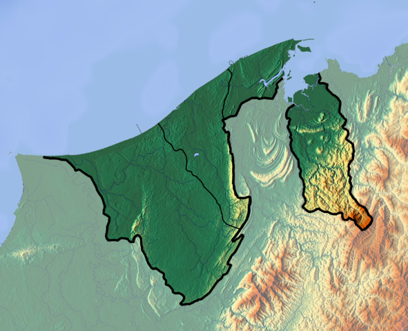
Deutsch: Positionskarte von Brunei
Quadratische Plattkarte. Geographische Begrenzung der Karte:
English: Location map of Brunei
Equirectangular projection. Geographic limits of the map:
|
| កាលបរិច្ឆេទ | |
| ប្រភព |
ការងារផ្ទាល់របស់អ្នកផ្ទុកឡើង
|
| អ្នកនិពន្ធ | Dr Brains |
ការដាក់អាជ្ញាប័ណ្ណ
I, the copyright holder of this work, hereby publish it under the following licenses:

|
Permission is granted to copy, distribute and/or modify this document under the terms of the GNU Free Documentation License, Version 1.2 only as published by the Free Software Foundation; with no Invariant Sections, no Front-Cover Texts, and no Back-Cover Texts. A copy of the license is included in the section entitled GNU Free Documentation License. | 1.2 only |
|
|
Permission is granted to copy, distribute and/or modify this document under the terms of the GNU Free Documentation License, Version 1.3 or any later version published by the Free Software Foundation; with no Invariant Sections, no Front-Cover Texts, and no Back-Cover Texts. A copy of the license is included in the section entitled GNU Free Documentation License.
|
You may select the license of your choice.
ប្រវត្តិឯកសារ
ចុចលើម៉ោងនិងកាលបរិច្ឆេទដើម្បីមើលឯកសារដែលបានផ្ទុកឡើងនៅពេលនោះ។
| ម៉ោងនិងកាលបរិច្ឆេទ | កូនរូបភាព | វិមាត្រ | អ្នកប្រើប្រាស់ | យោបល់ | |
|---|---|---|---|---|---|
| បច្ចុប្បន្ន | ម៉ោង១១:២២ ថ្ងៃអាទិត្យ ទី១០ ខែមិថុនា ឆ្នាំ២០១២ | | ២៣៣១ × ១៨៩២ (៥.៩២មេកាបៃ) | Dr Brains |
បម្រើបម្រាស់ឯកសារ
3 ទំព័រ ខាងក្រោមប្រើប្រាស់ឯកសារនេះ ៖
បម្រើបម្រាស់ឯកសារជាសាកល
វីគីដទៃទៀតដូចខាងក្រោមនេះប្រើប្រាស់ឯកសារនេះ៖
- ការប្រើប្រាស់នៅក្នុង ar.wikipedia.org
- ការប្រើប្រាស់នៅក្នុង ast.wikipedia.org
- ការប្រើប្រាស់នៅក្នុង bcl.wikipedia.org
- ការប្រើប្រាស់នៅក្នុង bn.wikipedia.org
- ការប្រើប្រាស់នៅក្នុង bs.wikipedia.org
- ការប្រើប្រាស់នៅក្នុង ceb.wikipedia.org
- ការប្រើប្រាស់នៅក្នុង ce.wikipedia.org
- ការប្រើប្រាស់នៅក្នុង cs.wikipedia.org
- ការប្រើប្រាស់នៅក្នុង el.wikipedia.org
- ការប្រើប្រាស់នៅក្នុង en.wikipedia.org
- Brunei
- Geography of Brunei
- Bandar Seri Begawan
- Brunei Bay
- Jerudong Park
- Brunei Open
- Pagon Hill
- Aberdeen Brunei Senior Masters
- Tasek Merimbun
- Ulu Temburong National Park
- Module:Location map/data/Brunei/doc
- Batu Apoi Forest Reserve
- Seria oil field
- Benutan Dam
- Ulu Tutong Dam
- Ash-Shaliheen Mosque
- Pehin Khatib Abdullah Mosque
- Hassanal Bolkiah Mosque
- Hassanal Bolkiah Mosque, Mentiri
- Module:Location map/data/Brunei
- Kedayan River
- Kianggeh River
- Jerudong Park Amphitheater
- Saeh Hill
- Retak Hill
- Tudal Hill
- Lalak Lake
- Serasa Bay
- Teraja Waterfall
- ការប្រើប្រាស់នៅក្នុង fa.wikipedia.org
- ការប្រើប្រាស់នៅក្នុង fr.wikipedia.org
View more global usage of this file.