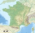
ឯកសារ:France relief location map.jpg

ទំហំរបស់ការមើលមុននេះ: ៦២៤ × ៦០០ ភីកសែ។ ភាពម៉ត់ផ្សេងទៀត៖ ២៥០ × ២៤០ ភីកសែ | ៤៩៩ × ៤៨០ ភីកសែ | ៧៩៩ × ៧៦៨ ភីកសែ | ១០៦៦ × ១០២៤ ភីកសែ | ២០០០ × ១៩២២ ភីកសែ។
រូបភាពដើម (២០០០ × ១៩២២ ភីកសែល ទំហំឯកសារ៖ ៩០៧គីឡូបៃ ប្រភេទ MIME៖ image/jpeg)
ប្រវត្តិឯកសារ
ចុចលើម៉ោងនិងកាលបរិច្ឆេទដើម្បីមើលឯកសារដែលបានផ្ទុកឡើងនៅពេលនោះ។
| ម៉ោងនិងកាលបរិច្ឆេទ | កូនរូបភាព | វិមាត្រ | អ្នកប្រើប្រាស់ | យោបល់ | |
|---|---|---|---|---|---|
| បច្ចុប្បន្ន | ម៉ោង១៥:០១ ថ្ងៃព្រហស្បតិ៍ ទី១៩ ខែតុលា ឆ្នាំ២០១៧ |  | ២០០០ × ១៩២២ (៩០៧គីឡូបៃ) | Sting | No borders over the Lake of Constance |
| ម៉ោង០៨:៤៤ ថ្ងៃអាទិត្យ ទី០៣ ខែមករា ឆ្នាំ២០១៦ |  | ២០០០ × ១៩២២ (៨៨៨គីឡូបៃ) | Jack ma | updated new administrative region boundaries 1/1/2016 | |
| ម៉ោង១២:៣១ ថ្ងៃអង្គារ ទី០២ ខែតុលា ឆ្នាំ២០១២ |  | ២០០០ × ១៩២២ (៨១៤គីឡូបៃ) | Palosirkka | Reverted to version as of 22:20, 17 July 2010 Location maps must remain very accurate | |
| ម៉ោង០៩:១៤ ថ្ងៃអង្គារ ទី០២ ខែតុលា ឆ្នាំ២០១២ |  | ២០០០ × ១៩២២ (៧៩៧គីឡូបៃ) | Palosirkka | Optimized with http://trimage.org | |
| ម៉ោង២២:២០ ថ្ងៃសៅរ៍ ទី១៧ ខែកក្កដា ឆ្នាំ២០១០ |  | ២០០០ × ១៩២២ (៨១៤គីឡូបៃ) | Sting | Color profile | |
| ម៉ោង១៤:១៥ ថ្ងៃអង្គារ ទី១៧ ខែវិច្ឆិកា ឆ្នាំ២០០៩ |  | ២០០០ × ១៩២២ (៨២២គីឡូបៃ) | Sting | Embedded sRGB profile | |
| ម៉ោង១៣:២៩ ថ្ងៃសុក្រ ទី០៧ ខែវិច្ឆិកា ឆ្នាំ២០០៨ |  | ២០០០ × ១៩២២ (៨០១គីឡូបៃ) | Sting | + boundary for Channel Islands ; - canals | |
| ម៉ោង១៦:៤១ ថ្ងៃសៅរ៍ ទី២៣ ខែសីហា ឆ្នាំ២០០៨ |  | ២០០០ × ១៩២២ (៨០៣គីឡូបៃ) | Sting | Larger strokes for boundaries | |
| ម៉ោង១៧:៥៨ ថ្ងៃសុក្រ ទី២៥ ខែកក្កដា ឆ្នាំ២០០៨ |  | ២០០០ × ១៩២២ (៨១៥គីឡូបៃ) | Sting | Variable scale | |
| ម៉ោង១៤:៤៦ ថ្ងៃសុក្រ ទី២៥ ខែកក្កដា ឆ្នាំ២០០៨ |  | ២០០០ × ១៩២២ (៨១៤គីឡូបៃ) | Sting | - border |
បម្រើបម្រាស់ឯកសារ
4 ទំព័រ ខាងក្រោមប្រើប្រាស់ឯកសារនេះ ៖
បម្រើបម្រាស់ឯកសារជាសាកល
វីគីដទៃទៀតដូចខាងក្រោមនេះប្រើប្រាស់ឯកសារនេះ៖
- ការប្រើប្រាស់នៅក្នុង als.wikipedia.org
- Grosser Belchen
- Donon
- Vorlage:Positionskarte Frankreich
- Planche des Belles Filles
- Vorlage:Positionskarte Frankreich Haut-Rhin
- Vorlage:Positionskarte Frankreich Bas-Rhin
- Vorlage:Positionskarte Frankreich Saône-et-Loire
- Vorlage:Positionskarte Frankreich Paris
- Vorlage:Positionskarte Frankreich Territoire de Belfort
- Vorlage:Positionskarte Frankreich Essonne
- Vorlage:Positionskarte Frankreich Pyrénées-Orientales
- Vorlage:Positionskarte Frankreich Pas-de-Calais
- Vorlage:Positionskarte Frankreich Normandie
- Vorlage:Positionskarte Frankreich Orne
- Vorlage:Positionskarte Frankreich Île-de-France
- Vorlage:Positionskarte Frankreich Nord
- Vorlage:Positionskarte Frankreich Moselle
- Vorlage:Positionskarte Frankreich Morbihan
- Vorlage:Positionskarte Frankreich Maine-et-Loire
- Vorlage:Positionskarte Frankreich Pays de la Loire
- Vorlage:Positionskarte Frankreich Loire-Atlantique
- Vorlage:Positionskarte Frankreich Isère
- Vorlage:Positionskarte Frankreich Ille-et-Vilaine
- Vorlage:Positionskarte Frankreich Okzitanien
- Vorlage:Positionskarte Frankreich Gard
- Vorlage:Positionskarte Frankreich Korsika
- Vorlage:Positionskarte Frankreich Corse-du-Sud
- Vorlage:Positionskarte Frankreich Nouvelle-Aquitaine
- Vorlage:Positionskarte Frankreich Dordogne
- Vorlage:Positionskarte Frankreich Bretagne
- Vorlage:Positionskarte Frankreich Finistère
- Vorlage:Positionskarte Frankreich Côtes-d’Armor
- Vorlage:Positionskarte Frankreich Bourgogne-Franche-Comté
- Vorlage:Positionskarte Frankreich Alpes-Maritimes
- Vorlage:Positionskarte Frankreich Provence-Alpes-Côte d’Azur
- Vorlage:Positionskarte Frankreich Alpes-de-Haute-Provence
- Vorlage:Positionskarte Frankreich Allier
- Vorlage:Positionskarte Frankreich Hauts-de-France
- Vorlage:Positionskarte Frankreich Aisne
- Vorlage:Positionskarte Frankreich Auvergne-Rhône-Alpes
- Vorlage:Positionskarte Frankreich Ain
- Vorlage:Positionskarte Frankreich Grand Est
- Vorlage:Positionskarte Frankreich Ardèche
- Vorlage:Positionskarte Frankreich Calvados
- Vorlage:Positionskarte Frankreich Cantal
- Vorlage:Positionskarte Frankreich Charente
- Vorlage:Positionskarte Frankreich Centre-Val de Loire
- Vorlage:Positionskarte Frankreich Charente-Maritime
- Vorlage:Positionskarte Frankreich Haute-Corse
- Vorlage:Positionskarte Frankreich Eure
View more global usage of this file.


