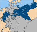
ឯកសារ:Map-DB-PrussiaProvs-1818.svg

Size of this PNG preview of this SVG file: ៦៨៤ × ៦០០ ភីកសែ. ភាពម៉ត់ផ្សេងទៀត៖ ២៧៤ × ២៤០ ភីកសែ | ៥៤៨ × ៤៨០ ភីកសែ | ៨៧៦ × ៧៦៨ ភីកសែ | ១១៦៨ × ១០២៤ ភីកសែ | ២៣៣៧ × ២០៤៨ ភីកសែ | ១៧៩៨ × ១៥៧៦ ភីកសែ។
រូបភាពដើម (ឯកសារប្រភេទSVG ១៧៩៨ × ១៥៧៦ ភីកសែល ទំហំឯកសារ៖ ១.២៧មេកាបៃ)
ប្រវត្តិឯកសារ
ចុចលើម៉ោងនិងកាលបរិច្ឆេទដើម្បីមើលឯកសារដែលបានផ្ទុកឡើងនៅពេលនោះ។
| ម៉ោងនិងកាលបរិច្ឆេទ | កូនរូបភាព | វិមាត្រ | អ្នកប្រើប្រាស់ | យោបល់ | |
|---|---|---|---|---|---|
| បច្ចុប្បន្ន | ម៉ោង០៩:៣២ ថ្ងៃអង្គារ ទី០៦ ខែកុម្ភៈ ឆ្នាំ២០០៧ |  | ១៧៩៨ × ១៥៧៦ (១.២៧មេកាបៃ) | Valentinian | Uploading the same image again in an attempt to overwrite the copy in the cache. |
| ម៉ោង២០:៤៦ ថ្ងៃច័ន្ទ ទី០៥ ខែកុម្ភៈ ឆ្នាំ២០០៧ |  | ១៧៩៨ × ១៥៧៦ (១.២៧មេកាបៃ) | 52 Pickup | New colouring scheme, corrected Schleswig. | |
| ម៉ោង០៩:២៣ ថ្ងៃអាទិត្យ ទី១៤ ខែមករា ឆ្នាំ២០០៧ |  | ១៧៩៨ × ១៥៧៦ (១.២៦មេកាបៃ) | 52 Pickup | new colour scheme | |
| ម៉ោង១០:៣១ ថ្ងៃសុក្រ ទី០៨ ខែធ្នូ ឆ្នាំ២០០៦ |  | ១៧៩៨ × ១៥៧៦ (១.២៦មេកាបៃ) | 52 Pickup | Missed a few spots | |
| ម៉ោង២៣:៣៩ ថ្ងៃព្រហស្បតិ៍ ទី០៧ ខែធ្នូ ឆ្នាំ២០០៦ |  | ១៧៩៨ × ១៥៧៦ (១.២៦មេកាបៃ) | Bonas | {{Information| |Description= The Kingdom of Prussia at the time of the formation of the German Confederation (1818) - with provincial borders. |Source= [[:en:Image:Map-DB-PrussiaProvs-1818.svg|Map-DB |
បម្រើបម្រាស់ឯកសារ
ទំព័រ ខាងក្រោមប្រើប្រាស់ឯកសារនេះ ៖
បម្រើបម្រាស់ឯកសារជាសាកល
វីគីដទៃទៀតដូចខាងក្រោមនេះប្រើប្រាស់ឯកសារនេះ៖
- ការប្រើប្រាស់នៅក្នុង af.wikipedia.org
- ការប្រើប្រាស់នៅក្នុង ar.wikipedia.org
- ការប្រើប្រាស់នៅក្នុង ast.wikipedia.org
- ការប្រើប្រាស់នៅក្នុង bg.wikipedia.org
- ការប្រើប្រាស់នៅក្នុង ca.wikipedia.org
- ការប្រើប្រាស់នៅក្នុង cs.wikipedia.org
- ការប្រើប្រាស់នៅក្នុង da.wikipedia.org
- ការប្រើប្រាស់នៅក្នុង de.wikipedia.org
- ការប្រើប្រាស់នៅក្នុង en.wikipedia.org
- ការប្រើប្រាស់នៅក្នុង es.wikipedia.org
- ការប្រើប្រាស់នៅក្នុង et.wikipedia.org
- ការប្រើប្រាស់នៅក្នុង frr.wikipedia.org
- ការប្រើប្រាស់នៅក្នុង fr.wikipedia.org
- ការប្រើប្រាស់នៅក្នុង gl.wikipedia.org
- ការប្រើប្រាស់នៅក្នុង he.wikipedia.org
- ការប្រើប្រាស់នៅក្នុង hr.wikipedia.org
- ការប្រើប្រាស់នៅក្នុង hu.wikipedia.org
- ការប្រើប្រាស់នៅក្នុង id.wikipedia.org
- ការប្រើប្រាស់នៅក្នុង is.wikipedia.org
- ការប្រើប្រាស់នៅក្នុង it.wikipedia.org
- ការប្រើប្រាស់នៅក្នុង mk.wikipedia.org
- ការប្រើប្រាស់នៅក្នុង nl.wikipedia.org
- ការប្រើប្រាស់នៅក្នុង nn.wikipedia.org
- ការប្រើប្រាស់នៅក្នុង no.wikipedia.org
- ការប្រើប្រាស់នៅក្នុង pl.wikipedia.org
- ការប្រើប្រាស់នៅក្នុង pt.wikipedia.org
- ការប្រើប្រាស់នៅក្នុង ro.wikipedia.org
- ការប្រើប្រាស់នៅក្នុង ru.wikipedia.org
- ការប្រើប្រាស់នៅក្នុង sh.wikipedia.org
- ការប្រើប្រាស់នៅក្នុង sl.wikipedia.org
View more global usage of this file.
