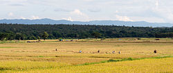
ខ្ពង់រាបថៃ
Appearance
| Thai Highlands | |
|---|---|
| Natural region | |
 | |
 | |
| Country | Thailand |
| Area | Northern Thailand, and parts of Tak and Sukhothai provinces |
| ផ្ទៃក្រឡា | |
| • សរុប | ១០៧០០០ គម2 (៤១០០០ ម៉ាយ ការ) |
| ប្រជាជន (2009) | |
| • សរុប | ៦៣០០០០០ |
| • សន្ទភាព | ៥៩/km2 (១៥០/sq mi) |
| ល្វែងម៉ោង | ICT (ម.ស.ស.+7) |
តំបន់ខ្ពង់រាបថៃ ឬ ភ្នំនៃភាគខាងជើងប្រទេសថៃ គឺជាតំបន់ធម្មជាតិ ភ្នំមួយនៅភាគខាងជើងនៃ ប្រទេសថៃ ។ ជួរភ្នំរបស់វាគឺជាផ្នែកនៃជួរភ្នំដែលលាតសន្ធឹងកាត់ ប្រទេសឡាវ ភូមា និង ប្រទេសចិន ហើយភ្ជាប់ទៅនឹង ភ្នំហិមាល័យ ដែលពួកវាអាចចាត់ទុកថាជា ជើងភ្នំ ។
