
ឯកសារ:Akrotiri and Dhekelia in United Kingdom.svg

Size of this PNG preview of this SVG file: ៥៧៨ × ៣២៥ ភីកសែ. ភាពម៉ត់ផ្សេងទៀត៖ ៣២០ × ១៨០ ភីកសែ | ៦៤០ × ៣៦០ ភីកសែ | ១០២៤ × ៥៧៦ ភីកសែ | ១២៨០ × ៧២០ ភីកសែ | ២៥៦០ × ១៤៣៩ ភីកសែ។
រូបភាពដើម (ឯកសារប្រភេទSVG ៥៧៨ × ៣២៥ ភីកសែល ទំហំឯកសារ៖ ៦.៩៧មេកាបៃ)
ចំណារពន្យល់
.svg)
.svg)
.svg)
.svg)
.svg)
.svg)
.svg)

-en.svg)

.svg)
.svg)
.svg)

_(US48).svg)
_(small_islands_magnified)_(-mini_map_-rivers).svg)
.svg)
_(extra_close)_(US48).svg)
.svg)
_(zoom).svg)

.svg)


_(UNMIK).svg)
.svg)
_(disputed_hatched).svg)
_(claimed_and_disputed_hatched).svg)
.svg)
.svg)
_(%2Ball_claims_hatched).svg)

.svg)
_(shade).svg)
_(shade)_(special_marker).svg)
_(-mini_map).svg)
_(-mini_map).svg)
_(-mini_map).svg)


.svg)

.svg)
ការដាក់អាជ្ញាប័ណ្ណ
I, the copyright holder of this work, hereby publish it under the following licenses:

|
រូបភាពនៃទំព័រនេះជាកម្មសិទ្ធិរបស់GNU Free Documentation License។ Version 1.2 ឬក៏ខ្ពស់ជាងនេះត្រូវបានឧបត្ថមគាំទ្រដោយ មូលនិធិសូហ្វវែរដោយឥតគិតថ្លៃ (Free Software Foundation) ដែលមិនមានផ្នែកណាមួយរបស់ប្រភពដើមរួមទាំងអក្សរនៅលើគំរបមុខនិងខ្នង ត្រូវបានផ្លាស់ប្តូរទេ។ ចំពោះផ្នែកដែលមិនអាចផ្លាស់ប្តូរបាន សូមមើលGNU Free Documentation License។ |
ឯកសារនេះជាប់អាជ្ញាបណ្ឌCreative Commons Attribution-Share Alike 3.0 Unported។
- អ្នកមានសិទ្ធិ៖
- ចែកចាយ – ថតចំលងនិងចែកចាយស្នាដៃនេះ
- កែច្នៃ – កែច្នៃយកទៅប្រើ
- ក្រោមលក្ខខណ្ឌដូចតទៅនេះ៖
- ភាពជាម្ចាស់កម្មសិទ្ធ – You must give appropriate credit, provide a link to the license, and indicate if changes were made. You may do so in any reasonable manner, but not in any way that suggests the licensor endorses you or your use.
- share alike – If you remix, transform, or build upon the material, you must distribute your contributions under the same or compatible license as the original.
You may select the license of your choice.

|
I'd greatly appreciate, that you attribute this media file to Wikimedia Commons, if used outside Wikipedia or Commons. For use in publications such as books, newspapers, blogs, websites, please insert here the following line:
|
ប្រវត្តិឯកសារ
ចុចលើម៉ោងនិងកាលបរិច្ឆេទដើម្បីមើលឯកសារដែលបានផ្ទុកឡើងនៅពេលនោះ។
| ម៉ោងនិងកាលបរិច្ឆេទ | កូនរូបភាព | វិមាត្រ | អ្នកប្រើប្រាស់ | យោបល់ | |
|---|---|---|---|---|---|
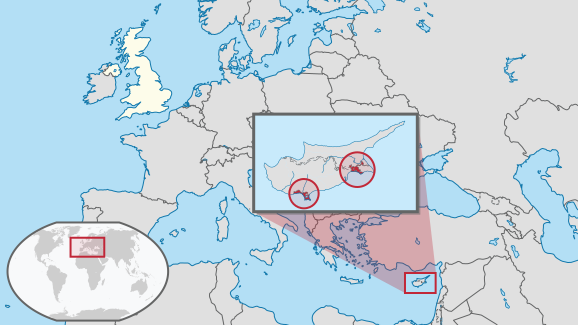
| បច្ចុប្បន្ន | ម៉ោង១២:៤៣ ថ្ងៃសុក្រ ទី០៥ ខែសីហា ឆ្នាំ២០១១ | | ៥៧៨ × ៣២៥ (៦.៩៧មេកាបៃ) | TUBS | {{Information |Description={{de|Lage des Überseegebietes XY (siehe Dateiname) im Vereinigten Königreich.}} {{en|Location of overseas territory xy (see filename) in the United Kingdom.}} |Source={{o |
បម្រើបម្រាស់ឯកសារ
2 ទំព័រ ខាងក្រោមប្រើប្រាស់ឯកសារនេះ ៖
បម្រើបម្រាស់ឯកសារជាសាកល
វីគីដទៃទៀតដូចខាងក្រោមនេះប្រើប្រាស់ឯកសារនេះ៖
- ការប្រើប្រាស់នៅក្នុង an.wikipedia.org
- ការប្រើប្រាស់នៅក្នុង ar.wikipedia.org
- ការប្រើប្រាស់នៅក្នុង ast.wikipedia.org
- ការប្រើប្រាស់នៅក្នុង az.wikipedia.org
- ការប្រើប្រាស់នៅក្នុង ba.wikipedia.org
- ការប្រើប្រាស់នៅក្នុង be.wikipedia.org
- ការប្រើប្រាស់នៅក្នុង bg.wikipedia.org
- ការប្រើប្រាស់នៅក្នុង bn.wikipedia.org
- ការប្រើប្រាស់នៅក្នុង ca.wikipedia.org
- ការប្រើប្រាស់នៅក្នុង cs.wikipedia.org
- ការប្រើប្រាស់នៅក្នុង da.wikipedia.org
- ការប្រើប្រាស់នៅក្នុង diq.wikipedia.org
- ការប្រើប្រាស់នៅក្នុង en.wikipedia.org
- ការប្រើប្រាស់នៅក្នុង eo.wikipedia.org
- ការប្រើប្រាស់នៅក្នុង es.wikipedia.org
- ការប្រើប្រាស់នៅក្នុង es.wikivoyage.org
- ការប្រើប្រាស់នៅក្នុង fi.wikipedia.org
- ការប្រើប្រាស់នៅក្នុង ga.wikipedia.org
- ការប្រើប្រាស់នៅក្នុង gl.wikipedia.org
- ការប្រើប្រាស់នៅក្នុង he.wikipedia.org
- ការប្រើប្រាស់នៅក្នុង hi.wikipedia.org
- ការប្រើប្រាស់នៅក្នុង ilo.wikipedia.org
- ការប្រើប្រាស់នៅក្នុង it.wikipedia.org
- ការប្រើប្រាស់នៅក្នុង ja.wikipedia.org
- ការប្រើប្រាស់នៅក្នុង kk.wikipedia.org
- ការប្រើប្រាស់នៅក្នុង la.wikipedia.org
- ការប្រើប្រាស់នៅក្នុង ml.wikipedia.org
- ការប្រើប្រាស់នៅក្នុង ms.wikipedia.org
- ការប្រើប្រាស់នៅក្នុង my.wikipedia.org
- ការប្រើប្រាស់នៅក្នុង nl.wikipedia.org
- ការប្រើប្រាស់នៅក្នុង no.wikipedia.org
- ការប្រើប្រាស់នៅក្នុង or.wikipedia.org
- ការប្រើប្រាស់នៅក្នុង pa.wikipedia.org
- ការប្រើប្រាស់នៅក្នុង pnb.wikipedia.org
- ការប្រើប្រាស់នៅក្នុង pt.wikipedia.org
- ការប្រើប្រាស់នៅក្នុង ru.wikipedia.org
View more global usage of this file.